
From my experience, HuntStand Pro offers many powerful features that positively impact my day-to-day hunting, but one of my absolute favorites is HuntStand Pro’s Monthly Satellite imagery. I’ve got plenty of reasons for this but a great example stems from a hunt I experienced several years ago in Oklahoma. My jaw dropped when I arrived that fall to hunt a chunk of that state’s public dirt. Here’s why. One year prior, I arrowed my best buck with a bow there, and saw two other hammers. The landscape teemed with crops, especially soybeans. And those soybeans had been a deer magnet.
However, this trip to my Sooner State hotspot was different. Very different. What had been booming soybean and corn fields the year before, were now nothing but sky-high grasses. Previously beaten-down trails now appeared to be virtually untraveled. Why was everything so different? Well, the habitat had taken a major slide — due to unforeseen spring flooding. The flooding had apparently decimated the crops before they even had a chance to grow.

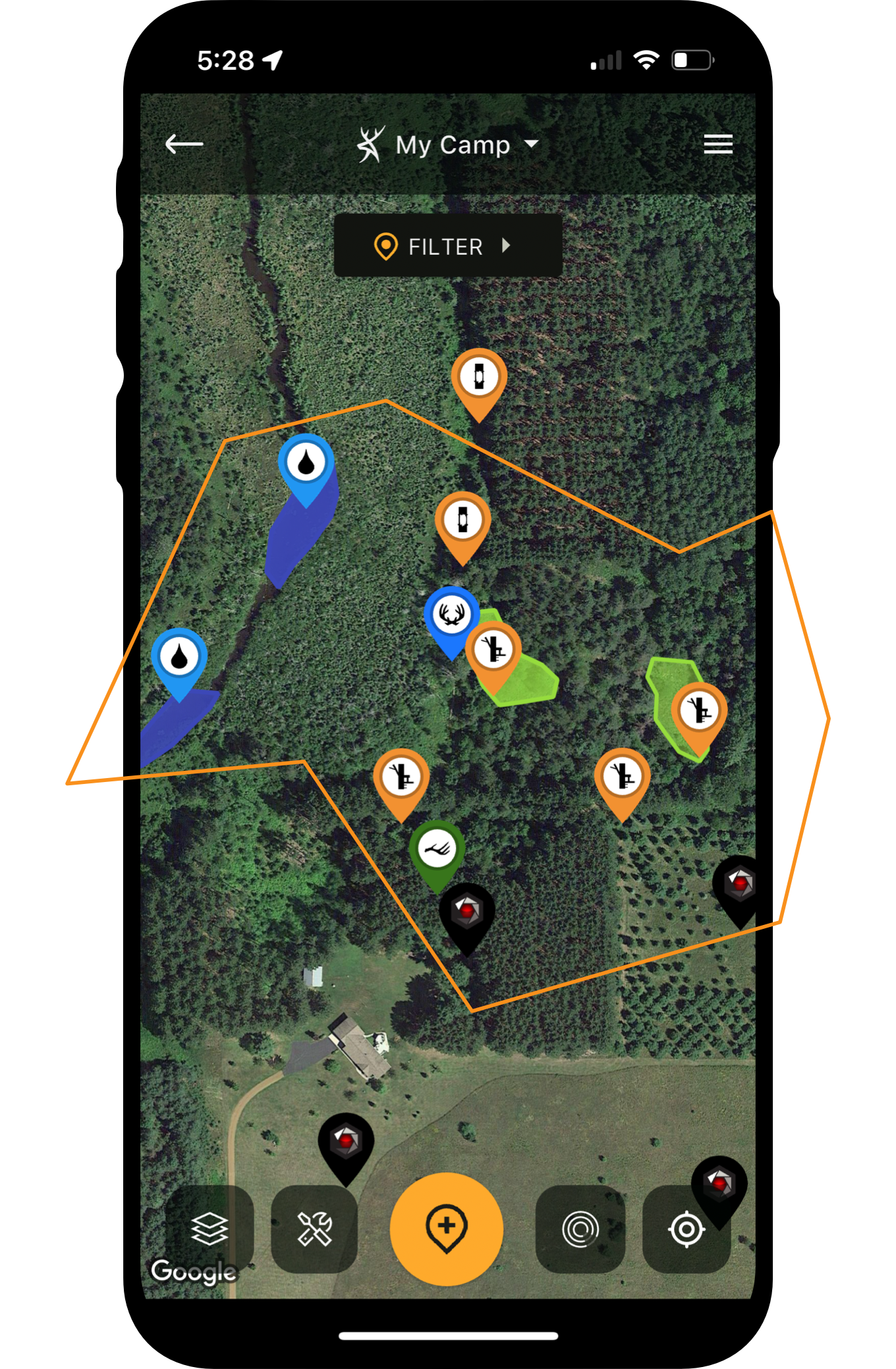
Anticipate how deer will react to changes on the landscape.
Hard-Earned Lesson
I don’t have to be told public-land hunting is almost always difficult, but it was obvious that the big habitat change had compounded the difficulty. In fact, I struggled to see a deer — any deer — during a week of pounding the Oklahoma whitetail woods. If I’d known things had changed so drastically, I could’ve tempered my expectations — and spent more time strategizing and developing back-up plans.
Fortunately, HuntStand Pro now makes it possible to peg notable habitat changes on a regular basis. With HuntStand’s Monthly Satellite Imagery feature, you can see important changes to the landscape without physically visiting your hunting location. For dedicated hunters, this is huge. You won’t see everything, but you’ll see most of the big things. It’s especially beneficial to hunters who cannot frequently visit a hunting lease, or those public parcels located a few hours away or farther. However, even if your property is just 10 minutes away, you could potentially benefit from this special capability.
Let’s discuss the many benefits of Monthly Satellite Imagery, and how this HuntStand Pro-exclusive feature can be a huge asset for identifying shifting domains. Follow along.
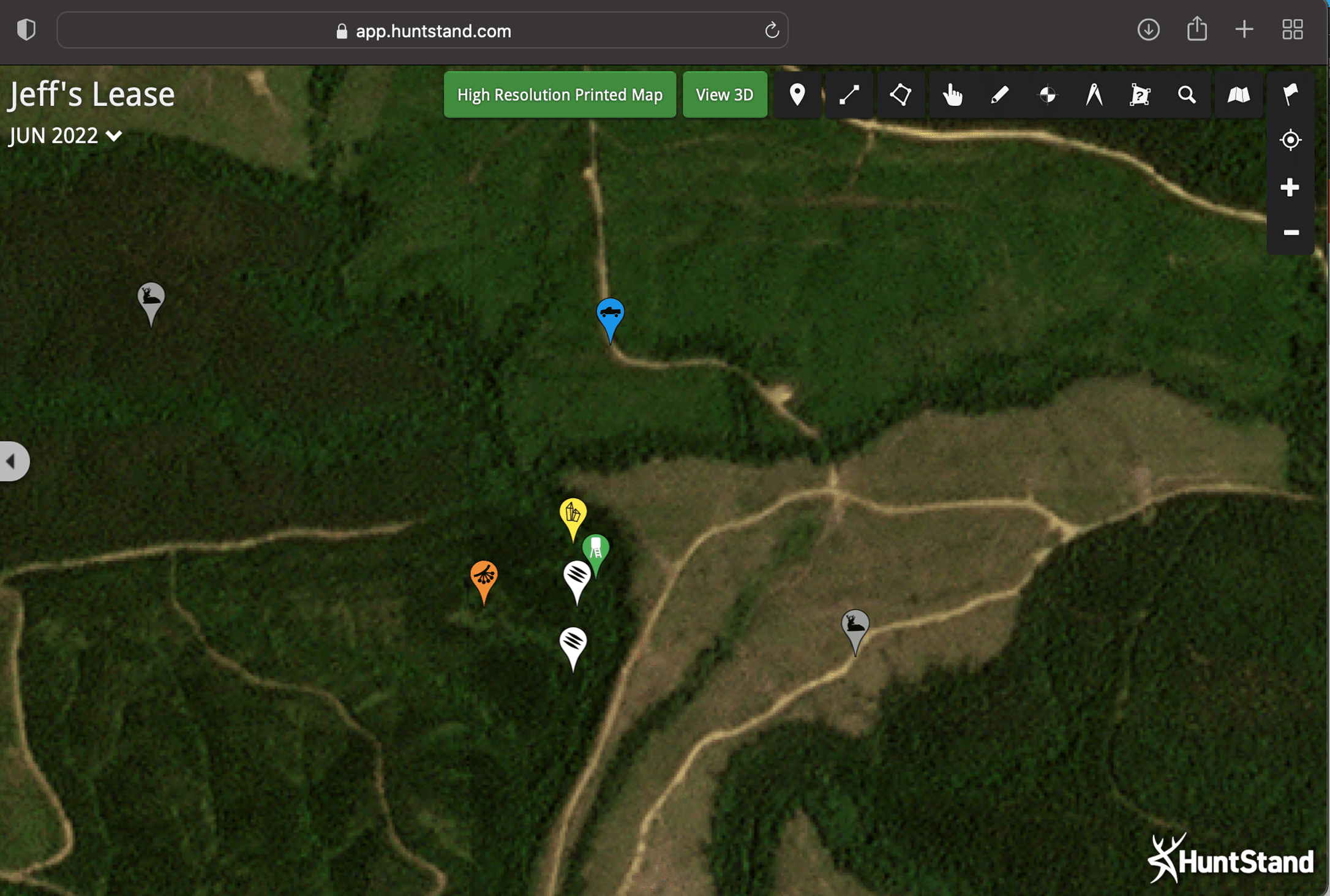
Here's the same hunt tract viewed with Monthly Satellite imagery. As you can see, a new, recent clearcut has totally changed the way this property should be hunted.
Whitetails and Changing Habitats
Whitetails are incredibly adaptive. Consider: Whitetails thrive most everywhere they exist across North America’s most-diverse eco-regions. From the sprawling plains of northeastern New Mexico to the huge forests of northern Maine, whitetails don’t just exist. No, they thrive, and it’s because they’re so adaptive.
Their adaptive nature is why their habits can substantially shift yearly, monthly and even weekly. What am I talking about? Well, remember that stand from which you saw three mature shooters two years ago during the rut? And how about when you sat it again one year later, and saw absolutely nothing? It doesn’t mean the stand has now morphed into a complete dud. Rather, it likely means that the local habitat has changed, and that deer have simply adapted to the changes.

Areas where timber cuts are common are susceptible to changing deer patterns, due to shifting domains. Nothing helps you see and react to these changes as quickly and efficiently as a HuntStand Pro subscription.
Change Comes in Many Forms
Changes can be as basic as crop rotations, or as severe as a clearcut that was previously a thick bedding area. Think about it in human terms. If you go to a beach to swim and find a sign stating that the beach is “closed until further notice,” you’re not going to wait there until it reopens. You’re going to adapt and go to another beach so you can swim as planned. Whitetails aren’t going to linger at a recent clearcut until regrowth provides new bedding cover. They’re going to adapt and bed somewhere else.
What habitat changes affect deer most? Food is number one. Stands that target deer movement going to or coming from food sources—or stands directly over food sources — are most susceptible to shifts in deer movement. For example, if a field is planted to soybeans one year, it’ll probably have a lot of deer activity around it. But, the following year when it’s planted to potatoes, it probably won’t be the deer hub it was a year ago when it was a bean buffet.

“The advent of HuntStand Pro’s Monthly Satellite Imagery layer puts you on top of habitat changes, so that you can adjust your hunting plans accordingly.”

Darren McDougal
HuntStand ProLook For the Silver Lining
Understand that food-source changes aren’t all negative. For example, when a standing cornfield is picked, it reduces cover, causing deer to bed in the timber or adjacent cover. This makes it easier to determine where deer will bed because there are now fewer cover options. It also creates more visibility from stands overlooking the field, which previously offered only edge visibility.
Other habitat changes that can greatly affect deer movement are the result of flooding, wildfires and timber cuts, to name a few. In the past, satellite mapping hasn’t been a reliable source for identifying these key changes/alterations. Often, satellite map views are well-outdated, and the only way to know what’s currently happening in your neck of the whitetail woods was to physically visit the property. Even then, happenings on adjacent properties remained mysteries.
Change has come. The advent of HuntStand Pro’s Monthly Satellite Imagery layer puts you on top of habitat changes, so that you can adjust your hunting plans accordingly. Let’s dive a bit deeper into how it happens.
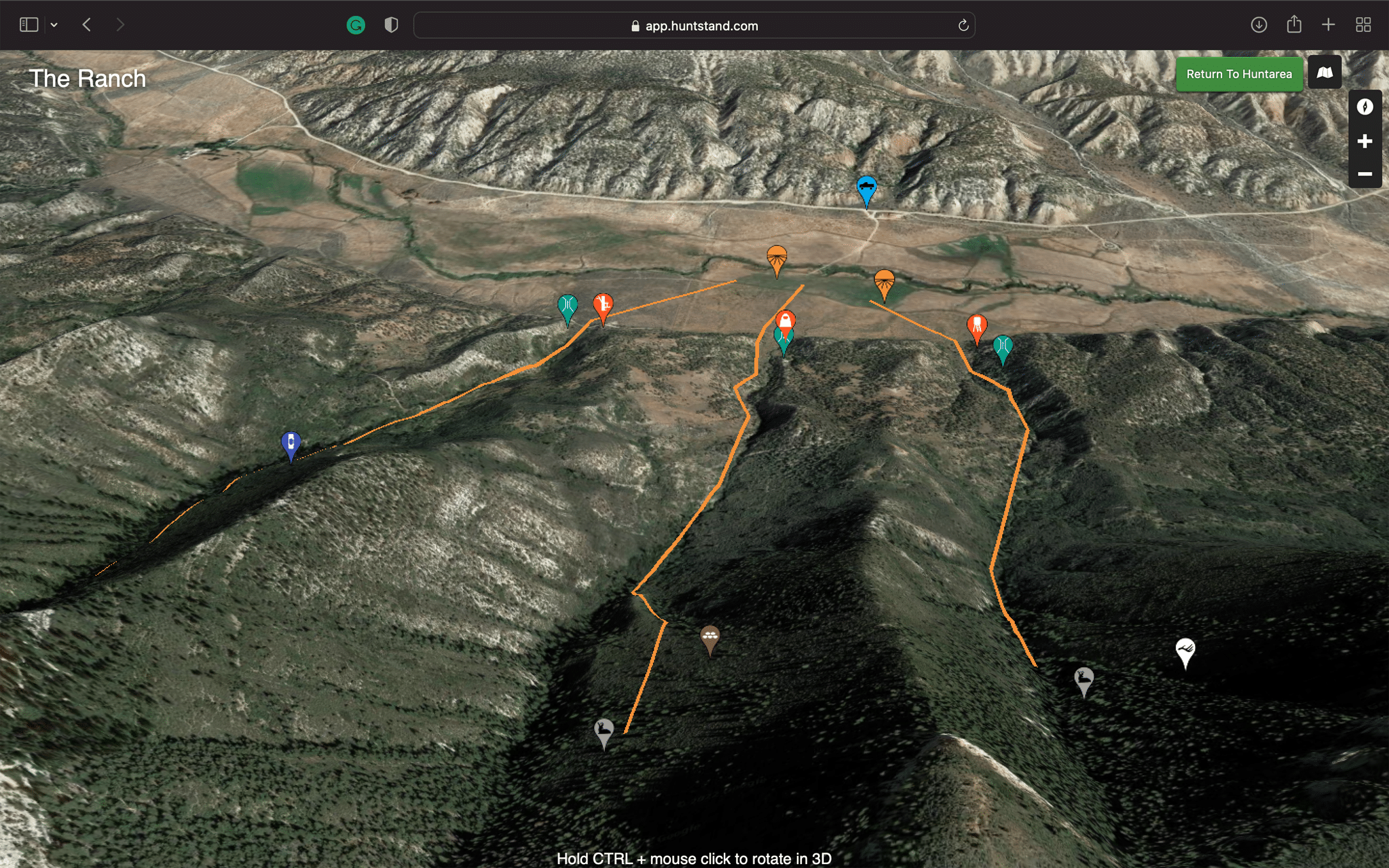
Use the Monthly Satellite to see recent changes.
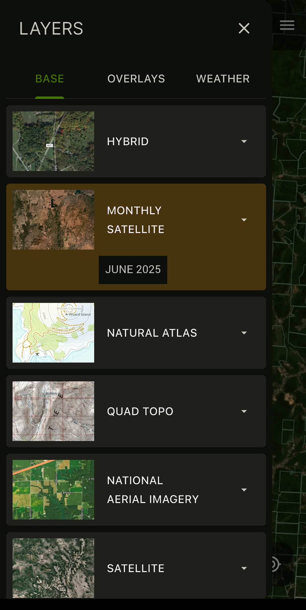
How Monthly Satellite Imagery Works
How does HuntStand’s Monthly Satellite Imagery work? Well, when you subscribe to HuntStand Pro, it become an available base layer that you can utilize in your map scouting. Aptly named, Monthly Satellite Imagery provides an updated satellite view on the seventh day of every month. The only downside is that the resolution is somewhat lower than in the other base layers. Still, the advantage of an updated view is worth a lot in identifying monumental habitat changes. Interestingly, HuntStand was first among consumer mapping apps to accomplish this.
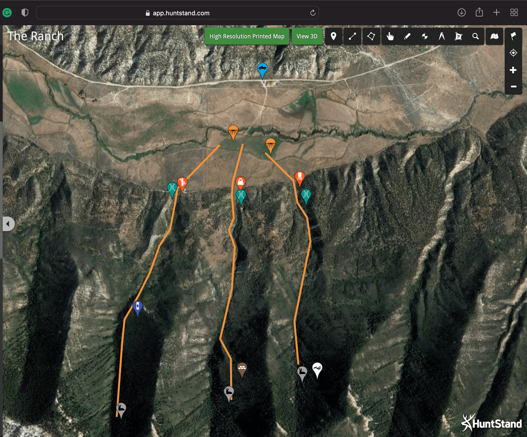
Out west, the deep canyons that provide thick bedding cover dive off to an alfalfa field below. Deer can be intercepted at the funnels where these canyons meet the farm habitat.
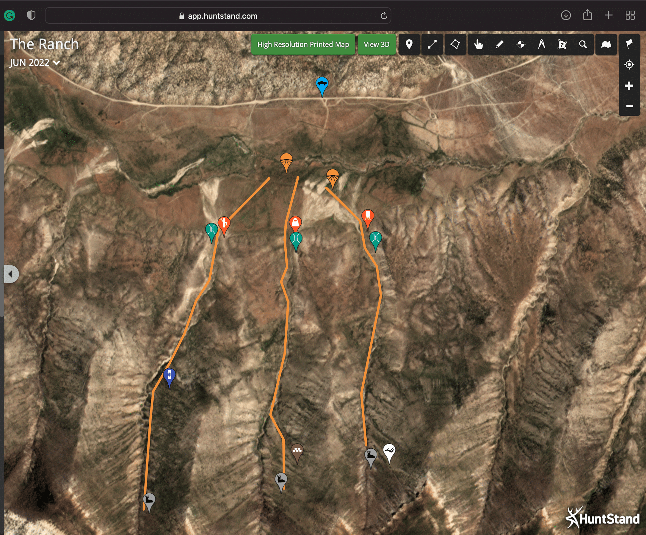
This view of the same tract using HuntStand's Monthly Satellite Imagery shows a recent fire has totally decimated the bedding cover in the canyons. This will surely change animal patterns, and you can expect even more change as regrowth emerges.
How valuable is the Monthly Satellite layer? This image of the same hunting area shows HuntStand's amazing 3-D view capability in play, and it certainly provides a more-detailed perspective of the lay of the land. However, this view is outdated, as it doesn’t show the habitat wipeout caused by the wildfire. Monthly updates are amazing!
Using the Layer to Speed Scout
So, how does this layer apply to your hunting strategy? Let me offer a couple of examples to get you thinking. First, imagine that you live in Wisconsin, and that you’re planning to hunt another state, an area that’s 10 hours away. You’ve heard rumblings that a wildfire has recently hit the area, but you’re not sure if it wiped out the habitat. You don’t even know if the blaze affected your stand locations at all. Should you call off the trip or travel elsewhere? Many likely would.
Not so fast! You can jump on the Monthly Satellite Imagery layer to identify areas that burned and areas that did not. If the burn happened well before deer season, you could track regrowth progression every month, as this could make edges of the burn productive places to hunt over natural foods. This might require tweaking your original stand placement, but at least you’re aware of what has changed before you arrive. It means you can be much more efficient, and waste less time, when you arrive to hunt.
Another instance monthly updates could prove beneficial is if your stand location in a western state hinges on a large pond being full or dried up. If the water source is visible from the sky, you should be able to see if it’s holding water — or if drought conditions have dried it up. Knowing this without physically being on site is a huge benefit — and a major timesaver.
How to Manage Hunt Clubs & Leases with HuntStand Pro
Knowledge Is Power!
Now, does the Monthly Satellite Imagery layer replace HuntStand Pro’s other helpful base layers? Absolutely not. Does it let you see if oaks are dropping acorns right now? Nope. And that’s OK, because a few unsolved mysteries are part of hunting. I mean, what fun would hunting be if an app gave you coordinates to a world-class buck caught up in a fence? The unknowns make hunting interesting, and your physical commitment — boots-on-the-ground scouting and hunting — will help validate your virtual-scouting efforts. HuntStand won’t kill a deer for you.
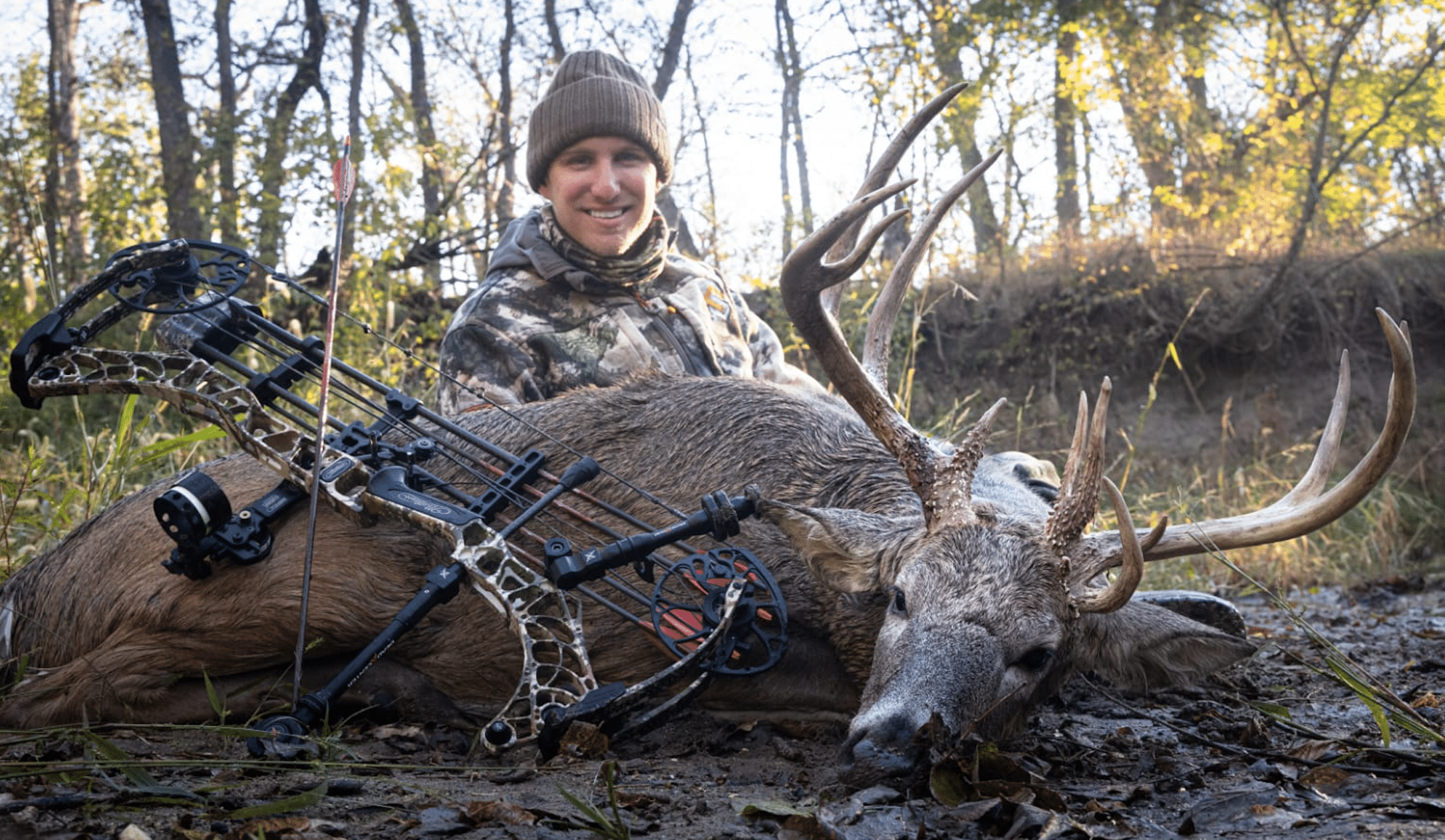
The Bowhunt or Die crew, including Tyler Barron shown here with a stud Kansas buck, relies heavily on HuntStand Pro’s many features including Monthly Satellite imagery.
Here’s the takeaway: Without physically visiting a property, you don’t get the benefit of knowing what spring floods did to your lease in another state. Nor would you know how a recent clearcut impacted a historical bedding area on your local property. That is, unless you subscribe to HuntStand Pro — and leverage the serious power of the Monthly Satellite Imagery layer. I believe you’ll agree that the layer has a valuable place in scouting, regardless of where or what game animals you hunt. And from my experience, HuntStand Pro’s Monthly Satellite imagery will show its value whether you own, lease, or hunt exclusively on public lands. Try it and see!