




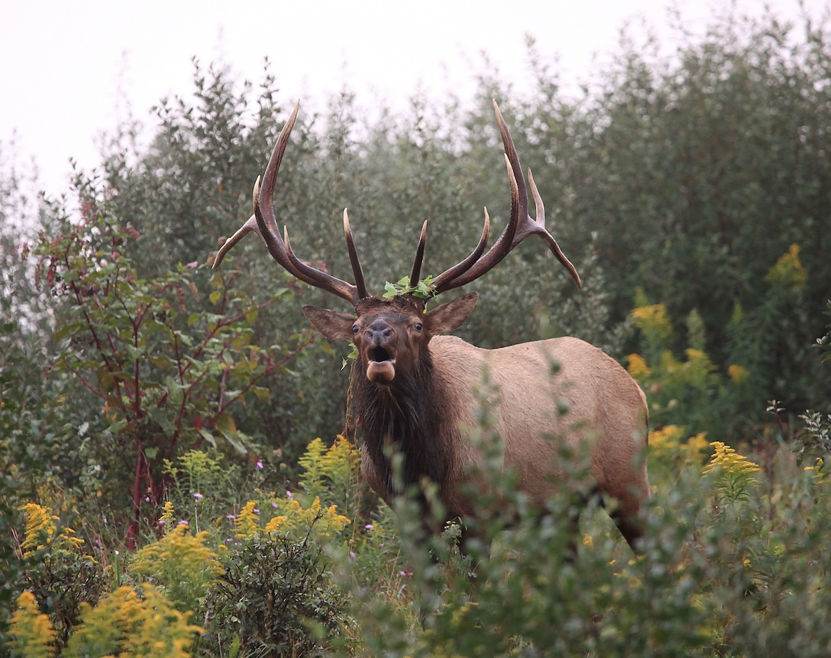

Elk often graze in mountain meadows, which are easy to locate on the Hybrid map.
Scores of elk hunters annually hit the mountains, but only around 10% to 20% walk off the mountain with full packs. According to the Rocky Mountain Elk Foundation, 130,300 elk tags were available for Colorado’s 2025 hunting season. Assuming the success percentage above is accurate — it has been for many years — hunters took 13,030-26,060 elk last fall.
For perspective, Colorado has more elk than any other Western state. The Colorado Parks and Wildlife Commission estimates that 280,000 Wapiti roam within its borders. In other words, low success rates aren’t for a lack of animals. Rugged terrain that makes elk tough to reach, unpredictable winds and thermals, unresponsiveness to calling (particularly in areas with high hunter pressure), and difficult shooting opportunities are just a handful of reasons why elk hunters face slim odds.
Still, there are ways to boost your personal odds. Before we continue, subscribe to HuntStand Ultimate (if you haven’t already done so). It won’t stuff your pack with meat and antlers; you’ll still have to work your butt off. But Ultimate puts actionable tools at your fingertips that can streamline your first elk hunt and tip the odds your way. Here are 20 to get you started.
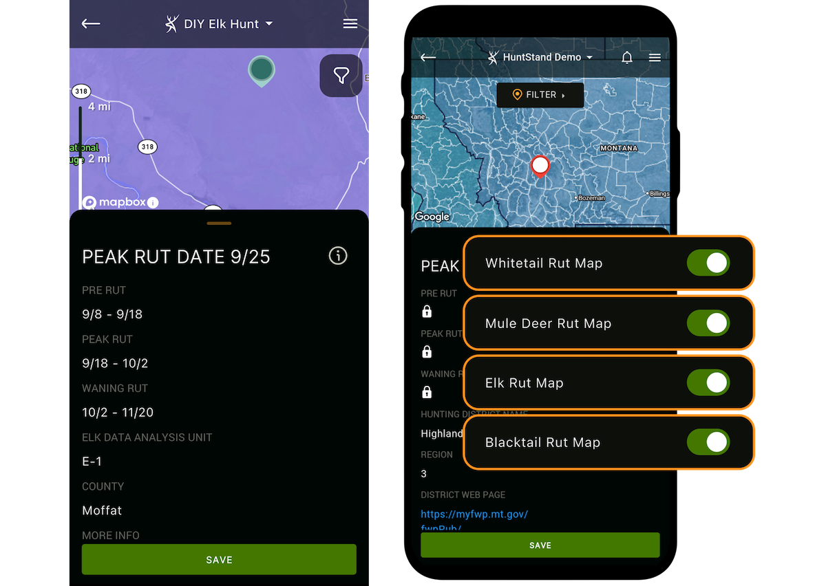
The Elk Rut Map can help you pick hunt dates that accurately coincide with the rut phase you want to hunt.
1. Choose Productive Hunt Dates
You’ve drawn an elk tag, and it’s time to select hunt dates. Visit Internet hunting forums or talk with seasoned hunters, and you’ll get several answers as to when the best hunting dates are, which can be confusing. Some believe the same dates are best every year, while others might plan around the moon or other factors.
Now, elk hunts outside the rut can be very weather-dependent, so this section will focus specifically on the rut since we cannot accurately predict snow and frigid temperatures months in advance. But if your tag is valid during any part of the rut, lean in. HuntStand Ultimate’s Elk Rut Map breaks down the rut into three phases — pre-rut, peak rut and waning rut — and provides calendar dates for each phase. Wildlife biologists were instrumental in developing this tool based on precision data from state game agencies. It’s accurate, and you won’t find it anywhere but in HuntStand Ultimate.
First, determine what type of hunt you want. Do you want to chase lone bulls that are seeking and aggressive during the pre-rut, shadow a herd being dogged by several satellite bulls during the peak rut, or catch a bull that’s still in the mood after most of the cows have been bred during the waning rut? Decide that, and then select your Hunt Area in the app. Select the Layer tab at the lower left, and then select Overlays. Engage the Elk Rut Map, and the map view will be shaded in blues and purples. Tap the exact area you will be hunting, and a window will display dates for each phase exclusive to that area, helping you time your hunt appropriately.
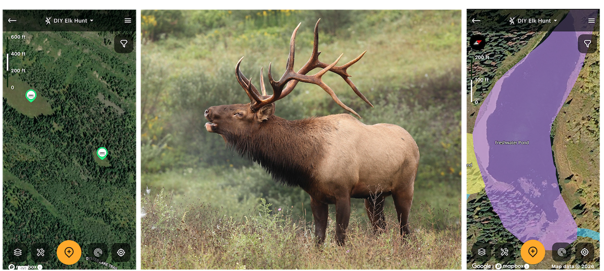
Elk must drink, so be sure there are some water sources near quality cover.
2. Identify Productive Elk Habitat In Your Unit
Elk can be almost anywhere. Elevation can be important on some hunts, especially in hot weather. Bulls like to be up around 10,000 feet (give or take) in units with that much elevation until winter weather pushes them downhill. First, locate your unit or zone using the Hunting Lands overlay and tap on the Hunting Lands tab at the bottom of the screen. Deselect all species except elk, and the elk units will be brightly outlined. Next, seeing the elevations for your hunting area is simple. Engage the Quad Topo base map, and elevations will pepper the map.
Elk can also be at medium and low elevations that provide cover, food and water. For cover, elk favorites are oak brush (in lower country) or aspens and dark evergreen timber in medium to high elevations. Use the Tree Cover overlay to identify quality cover. Food-wise, elk can thrive on what looks like nothing. Most mountain meadows provide all the grazing an elk needs. These are easy to locate on any of HuntStand’s satellite-based maps; just look for openings in the timber.
However, elk like candy, too. Corn, alfalfa, millet, canola, and more located adjacent to good elk cover often attract elk, and these are readily identifiable with the Crop History overlay. A lot of the feeding transpires at night on private property, but if BLM, National Forest, or other open access — use the Public Lands overlay — provides sound bedding cover, you’re in the game late in the afternoons or early in the mornings as elk move to and from agriculture.
An elk gets some water from grazing, but not enough to sustain itself for days. If there aren’t sustainable water sources in the area, there probably won’t be elk. Even if you’re not planning to hunt over water, mapping it can boost your confidence that an area holds elk. Find water sources by type using the Water Features overlay.
As you find cover, food and water, drop pertinent map markers on your findings.
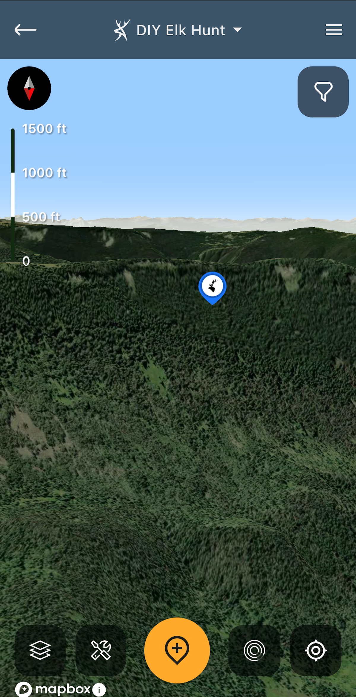
Use 3D Mapbox Satellite to identify cool, north-facing slopes where elk prefer to bed.
3. Peg Potential Bedding Areas
In the September heat, elk like dense cover for daytime bedding. Dense oak brush, aspens, or dark evergreen timber that provides shade and coolness are musts. Again, the Tree Cover overlay is the ticket. It’s common knowledge among elk hunters that north-facing slopes are the coolest and most inviting to elk, but as a first-timer, perhaps this is new news. It’s really easy to find slopes in the 3D Mapbox Satellite base map when you tilt the map to reveal the terrain. Be sure the red end of the compass arrow at the upper left is pointing towards 6 o’clock or south. Then, the slopes you’re seeing are north-facing.
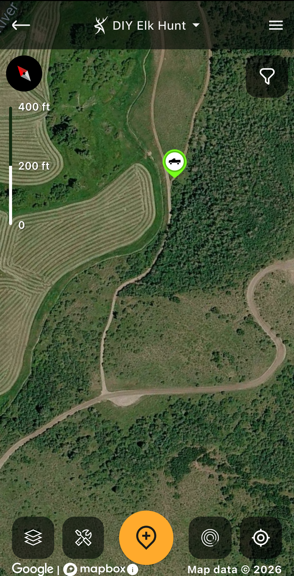
If a road that leads to public hunting land isn’t labeled and crosses private land, it’s likely a private road and doesn’t provide viable access.
4. Dial In Vehicular Access
Nothing is worse than aiming your vehicle towards a chunk of public land you’ve thoroughly e-scouted and coming to a locked gate or no trespassing sign. Unfortunately, some public lands are inaccessible. Sometimes, they even have roads going to them that look suitable but are privately owned. The Hybrid base map has road names on most accessible public roads. If it looks like a road but has no name and goes across private properties (be sure to check the Property Info overlay), don’t count on using it. If you have questions, check with a local game warden.
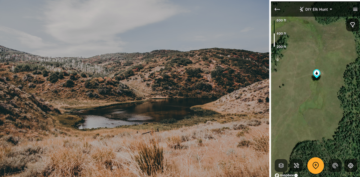
The Water Features overlay can help you find water sources where you can filter water for drinking.
5. Pinpoint Drinking Water
On a backcountry elk hunt, it’s not feasible to haul enough water for a weeklong pursuit, so camping and hunting near a water source is critical. Again, engage the Water Features overlay to map an oasis. Also, reference the Monthly Satellite map to make sure the creek, pond or lake hasn’t dried up. Then, you’ll have water to filter and drink.
6. Download Offline Maps
Most elk haunts have no cell coverage. That’s why it’s crucial to download a map of the area(s) you plan to hunt at home beforehand. Then, you’ll have full use of the features in your Hunt Area, regardless.
7. Identify Substantial Habitat Changes
Recent clearcuts or wildfires can adversely affect your hunt. Engage the Monthly Satellite base map to pinpoint areas with logging operations or wildfire burns. Pro tip: Burns or clearcuts a year or two old can provide great hunting as new forage emerges.
Plan for Public Land Elk Hunting
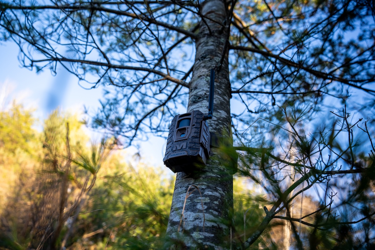
Run your cameras to gauge likely elk hunting spots of interest.
8. Integrate Your Trail Cams
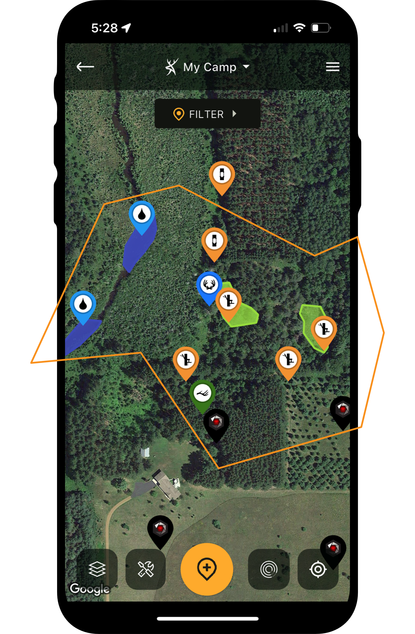
Trail cameras for elk? Absolutely. Find a waterhole or wallow and set a Muddy or Stealth Cam trail camera over it. Then, seamlessly integrate them with HuntStand to see your camera’s location on the map and track which areas are getting the most action.
9. Select Glassing Vantages
In elk habitat that provides long-range glassing opportunities, be sure to select several commanding glassing knobs in HuntStand before your hunt. The most effective way to do this is using 3D Mapbox Satellite. Not only will you be able to see the highest points but you’ll have a solid perspective of the visibility each glassing knob provides of outlying areas.
10. Use the Built-In Rangefinder
When a bull is bugling, and you aren’t sure how far he is or if you can reach him before dark, open the Hybrid map and compare the cover and terrain with what you’re seeing and hearing. If you have a good idea of where the bull is on the map, then you can double-tap the compass at the lower right to open navigation mode and the built-in range-finding tool. Now, you’ll be able to see how many yards you are from the bull’s prospective location and better decide whether to pursue.
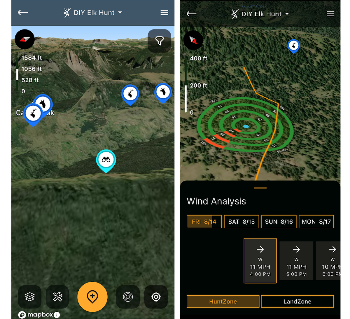
3D Mapbox Satellite is ideal for selecting glassing knobs and gaining a perspective of the view from each one. Always keeps tabs on the wind with HuntZone.
11. Master the Wind
Elk miss nothing with their sense of smell. Thermals can be unpredictable, especially during transitional times of the day. Wind can also be shifty in varied terrain. Check the wind before and during your hunt with HuntZone, which details hourly wind speeds and directions, and how your scent will disperse from your location. Also, use a wind detector often as you move about the timber.
12. Hunt a Manageable Area
When you locate large tracts of BLM or National Forest using the Public Land overlay, it’s tempting to become curious and hunt erratically rather than methodically. Sometimes, bulls don’t answer calls, but it doesn’t mean they aren’t there. Remember the map markers you initially dropped on cover, food and water? Stick to those and focus on the areas that you have the most confidence in. If you’re seeing steaming-fresh elk sign, but aren’t hearing bugles, avoid wandering all over the mountain. Focus on those areas and use the Line tool to determine hiking distances before your outings so that you can choose manageable hunts that won’t exhaust you.
13. Have a Plan B … and C
When doing your initial map scouting, always drop way more markers than you think you need and in a few different areas of your unit. Sometimes, you’ll find another hunter camped where you wanted to, or you’ll find that the area you thought looked the best is elk-less. Having alternate plans in the bullpen beats starting over from scratch.
Your Guide to Western Big Game Tag Draws
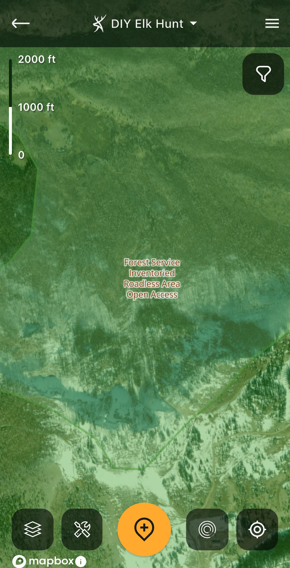
When hunting pressure mounts, elk typically retreat to roadless areas, which you can find using the Public Lands overlay.
14. Estimate Potential Pack-Out Distances and Difficulty
Everyone has physical limitations, some more than others. Don’t hunt where you will be unable to extract an elk within a reasonable time to avoid meat spoilage. Lots of people can hike in seven miles and kill an elk, but few can extract all of the meat on their own, whereas two or three hunters might collectively be able to.
HuntStand comes in handy for estimating pack-out distances and difficulty. Using the Line tool, draw a line from your vehicle or camp to places you intend to hunt. Is the distance doable? Remember that line-of-sight distance is different than a hike with inclines and declines, both in distance and difficulty. Be sure to reference Quad Topo to get a feel for elevation changes along the route. A hike with 1,000 feet of elevation change with elk meat can be daunting.
15. Reference the Map in Real-Time Before Closing the Distance
Cutting the distance to a bull before calling is best. Once you’ve located a bull, quickly reference 3D Mapbox Satellite and tilt the map to reveal the terrain features. Pan around and see what lies between you and the bull. You might identify terrain features that will make your approach easier and/or more discreet.
16. Be On the Mountain When It Counts
Hunting every morning and afternoon, or all day, is ideal, but burning out is a great way to lose your effectiveness. Taking a morning or afternoon off can rejuvenate you. Plan for this, especially on hunts longer than a week. But be sure to reference the Elk Activity Forecast, which provides movement scores based on algorithms that consider all factors that scientifically influence movement. Hunt when movement scores are high, and take a morning or afternoon off when movement scores are low.
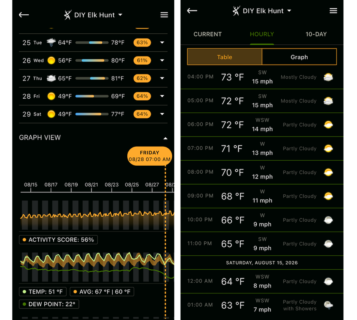
HuntStand’s weather forecast can help you identify incoming inclement weather and inform how you dress for the day’s hunt. When you need a break, take off a morning or afternoon when the movement scores in Elk Activity Forecast are low.
17. Plan for the Weather
Getting caught in a downpour is a great way to flirt with disaster. I know, because I put my wife and me in a situation just like this in Idaho. It started pouring before dark, and our truck was more than two miles away. Our path was slippery and tough to negotiate. Getting soaked in the mountains far from a heat source is a fast track to hypothermia, as nighttime temps can plummet below freezing. We got out fine, but I wouldn’t want to experience that again. Before every outing, reference HuntStand’s current and hourly weather forecast to avoid sketchy situations and choose your apparel wisely.
18. Determine Where Elk Go When Pressured
Some elk hunters hike miles to evade pressure, but you don’t want to hike past elk to find elk. I’ve gotten into bulls near parking areas and even paved highways. Of course, bulls that get heavily pressured will seek refuge in deeper haunts. I’ve found that if I bump elk, they usually end up in the next canyon (easy to locate using 3D Mapbox Satellite). But if an area is swarming with hunters, you’d best seek out tough-to-reach areas.
With HuntStand’s Public Lands overlay engaged, hover over large tracts of BLM and Forest Service lands. Watch for the words “Inventoried Roadless Area.” Drop markers on these spots. Given solid elk habitat with the necessities noted earlier, elk will likely retreat to these areas when pressured.
19. Map Your Pack-Out Route
Line of sight isn’t always the fastest or easiest route. Take off in the direction of your camp or vehicle, and you might face a frustrating and potentially dangerous cliff-out scenario, which forces you to reroute and adds more distance to your pack-out. Before loading up your meat, analyze the area using Quad Topo and 3D Mapbox Satellite to choose safe routes that minimize effort. If one route adds distance but avoids a major incline or decline, it might be superior. Also, watch for burn sites or old-growth timber, which will likely have deadfalls, making the going tough.
Terrain Features Elk Love
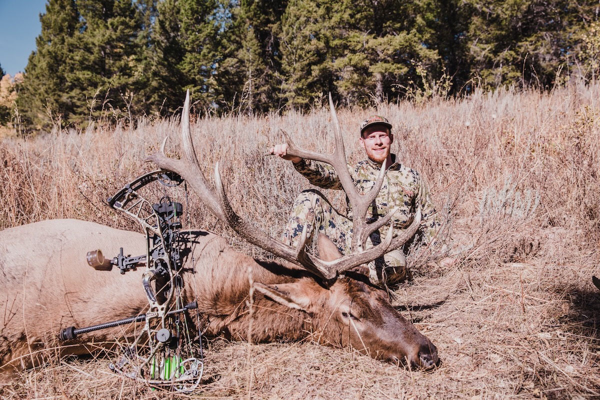
Elk have basic needs: cover, water and food. Connect those dots in good elk country, and the area will likely support some elk. Author Darron McDougal has hunted elk a bunch, and his field experience, along with HuntStand Ultimate usage, yielded this article’s informative tips. Here, McDougal shows the rewards of a tough Idaho hunt.
20. Fill In Your Gear Bag
Lastly, do you have holes in your gear list that need filling? Use your HuntStand Ultimate subscription to score huge discounts on cutlery, game bags, elk calls, headlamps, camping gear, and more.