





Hunt terrain features appropriately, and the odds begin shifting into your favor.
Topography is a major element of deer hunting. It influences how, when, where, and why deer do what they do. Terrain impacts everything from bedding areas to food sources to travel routes and more. Certain terrain features attract deer more than others. Fortunately, HuntStand helps locate these. Here’s how to find deer with topo maps.

Some terrain features are primo-, no-brainer hunting hotspots.
Reading Topo Lines and Terrain Features
The essence of reading topography maps entails reading and understanding contour lines. The distance between and orientation of topo lines indicate the lay of the land, and even identify the terrain features for the given area. For example, lines that are close together represent steep elevation changes. Lines that are further apart indicate gentler slopes. No lines, or lines very far apart, represent flatter ground. Thicker lines are called index lines, which help in gauging the elevation change (in feet) between topo lines.
Topo line configurations depict terrain features on the landscape. Recognizing these via topo-centric map layers in the HuntStand app can reveal key locations on any given hunting property. Some of these include:

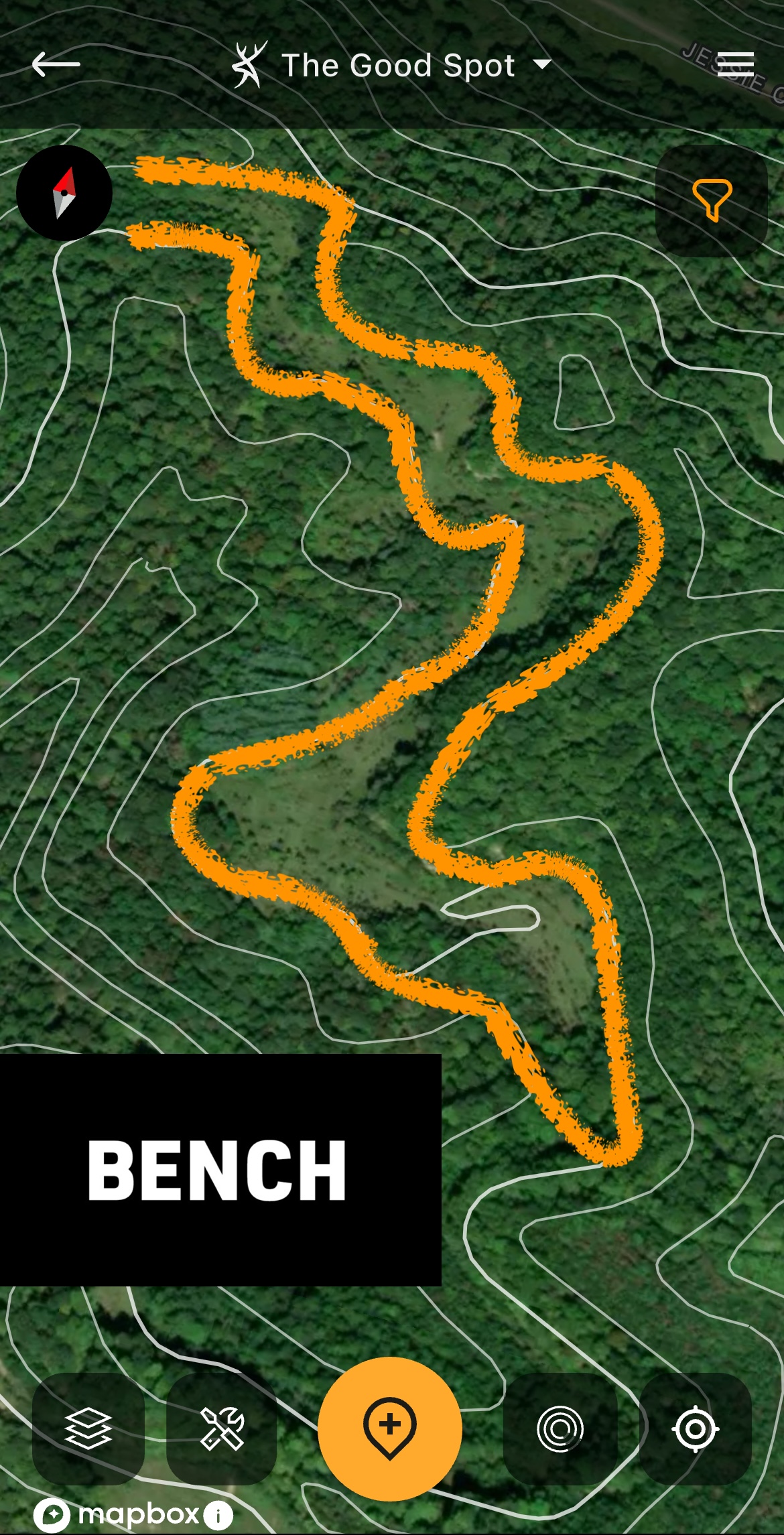
A bench displayed via the Contour layer.
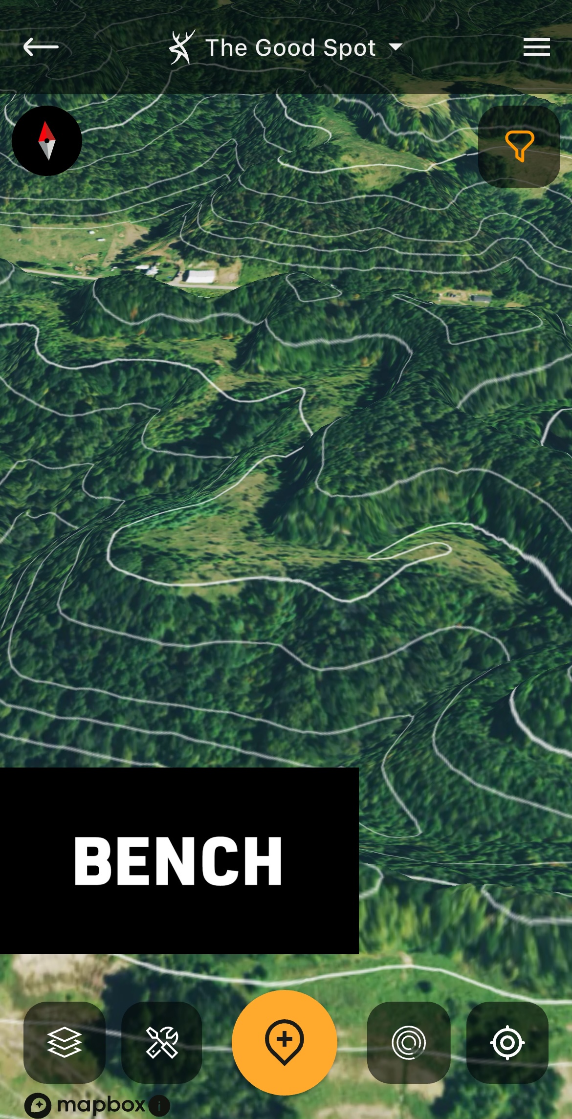
A bench shown in 3D.
Benches
A bench is a flat, navigable stretch of ground located between much steeper elevation changes above and below it.
Benches are used as travel routes by deer. They sometimes bed here as well. Generally, benches located two-thirds or three-quarters of the way up see more daylight deer movement. But those at higher elevations, and with early successional habits nearby, tend to produce more deer traffic.
The Best Times to Hunt the Whitetail Rut
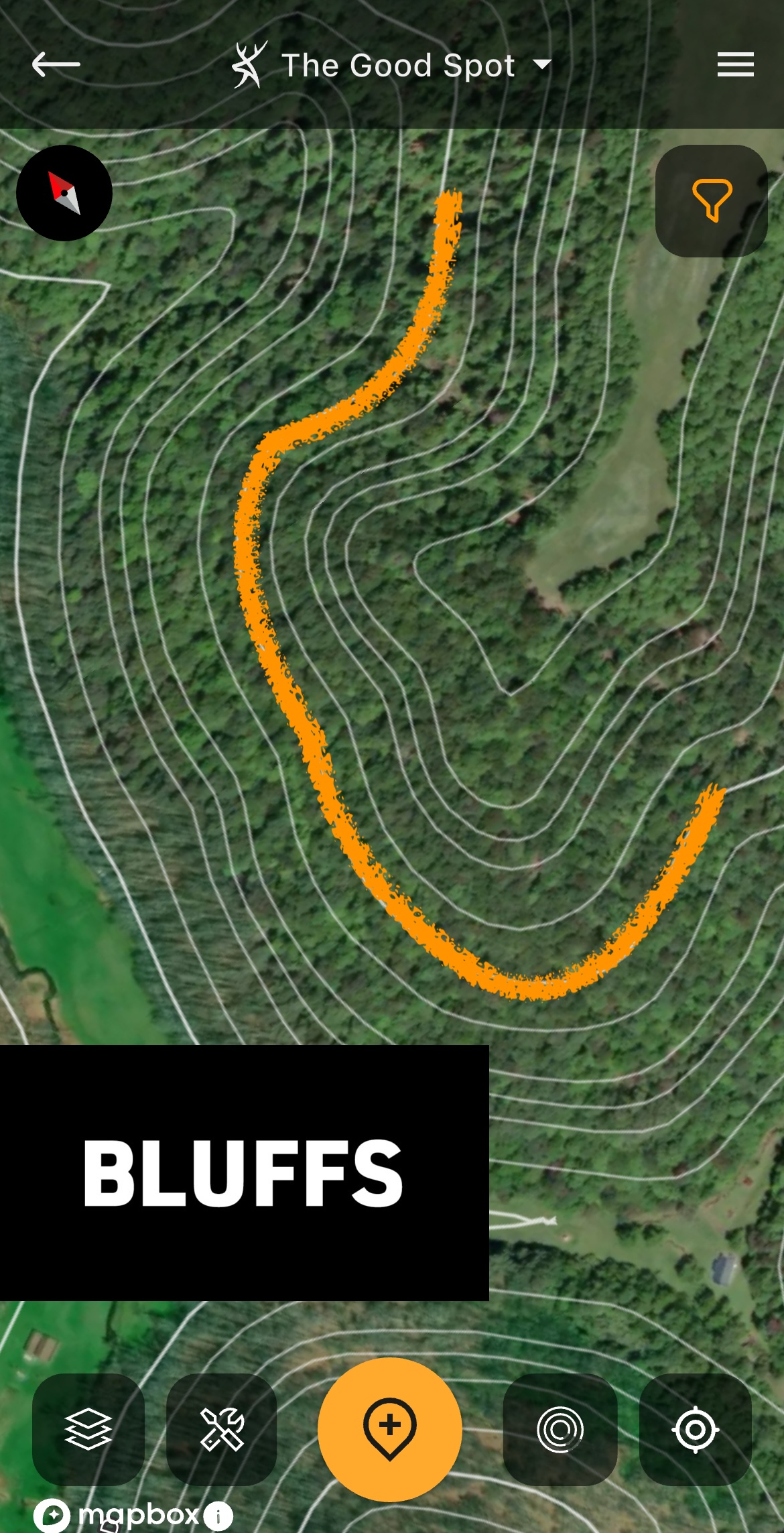
A bluff displayed via the Contour layer.
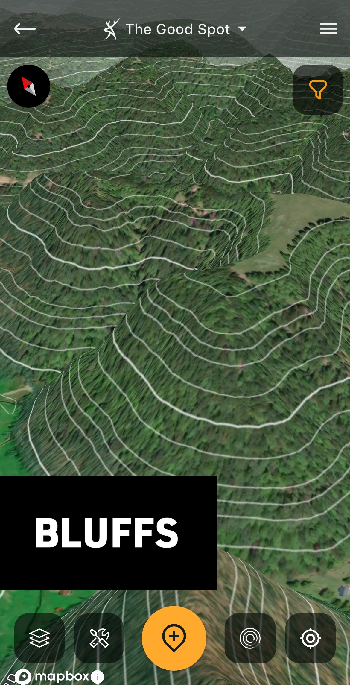
A bluff shown in 3D.
Bluffs
Also referred to as cliffs, sheer-cliffs, or drop-offs, bluffs are sudden and dramatic changes in elevation. These are important to note, especially for safety reasons.
Hunters can take advantage of bluffs by using these to keep deer from circling downwind of ground blinds and treestand locations. (For obvious safety reasons, don’t set up too close to the edge of bluffs.)
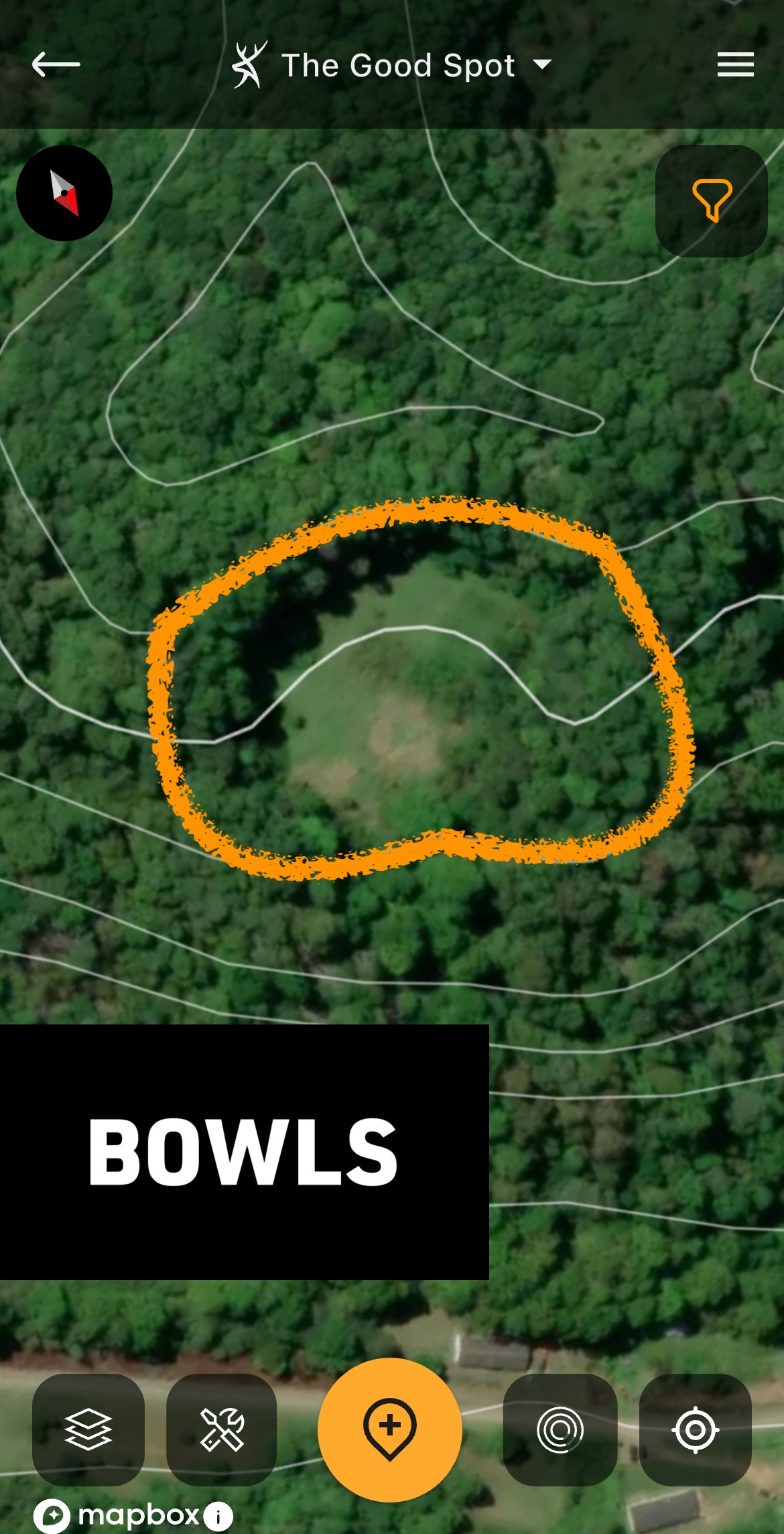
A bowl displayed via the Contour layer.
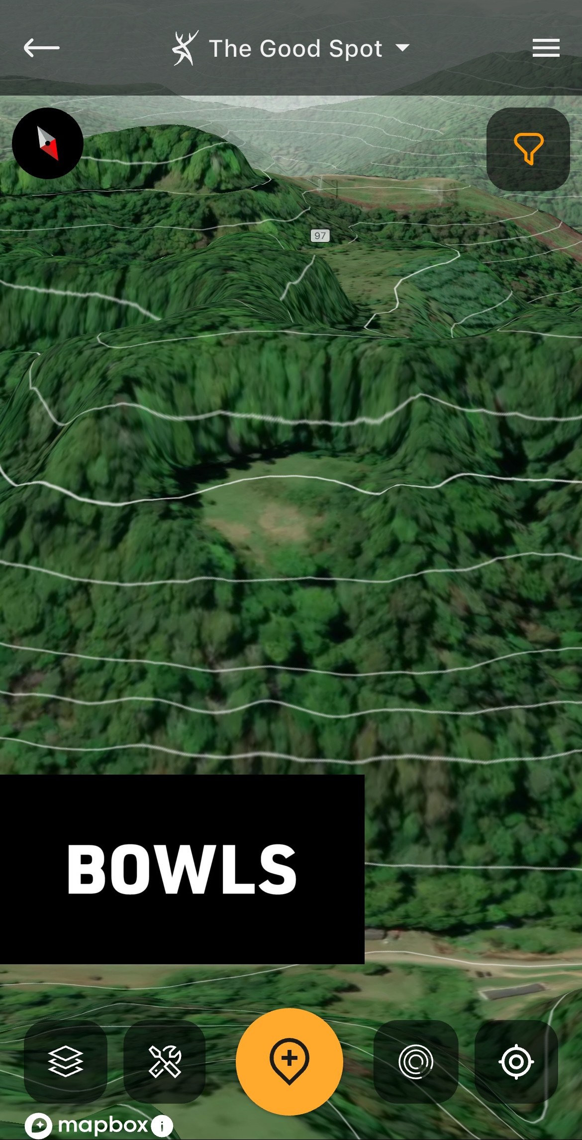
A bowl shown in 3D.
Bowls
A bowl is a relatively flat or gently sloping area surrounded by a ridge on three sides. The topo lines will create a semi-circle on three sides, creating a bowl shape.
Deer oftentimes bed and feed in these areas. In hill country, water seeps also commonly exist in these locations, making them great spots for intercepting thirsty deer.
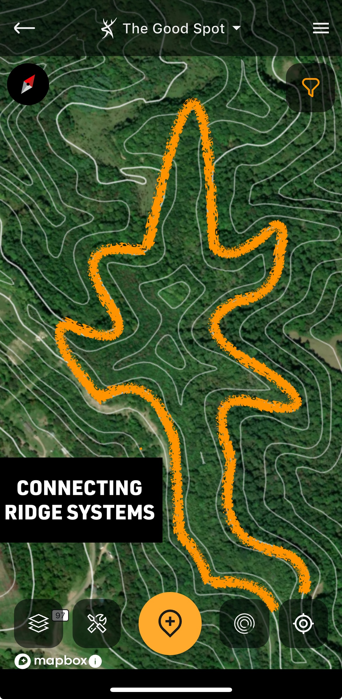
A connecting ridge system displayed via the Contour layer.
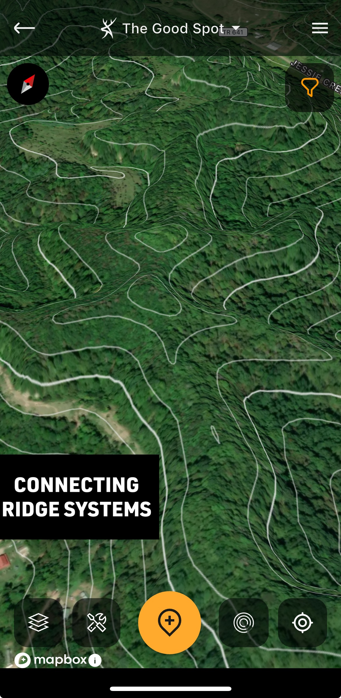
A connecting ridge system shown in 3D.
Connected Ridge Systems
These are areas where numerous ridge systems connect. If three or more ridges connect, that’s great. If four or five ridges meet in one spot, it can be truly incredible.
Usually, these spots are great all season long. This natural pinch point connects several areas of a buck’s home range, and can even become the intersection for all of the deer in the general area. Connected ridge systems are great during the rut.
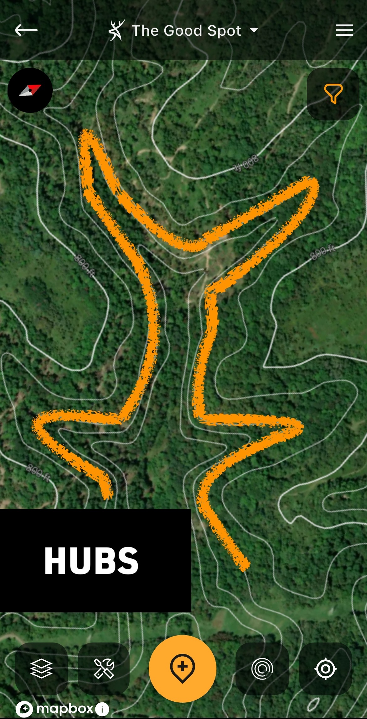
A thermal hub displayed via the Contour layer.
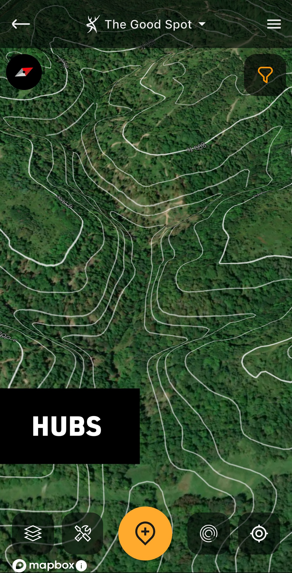
A thermal hub shown in 3D.
Hubs
Thermal hubs, also known as crow’s feet, are common in hill country. Recognized on topo maps as spokes on a wheel, a hub is a network of ridge endings and valleys that taper down into the same low-lying area.
Deer routinely use these areas for the wind advantages they offer. When thermals are falling, scent congregates from multiple directions down into the low-lying hub. Because of this, deer can detect danger from multiple directions.
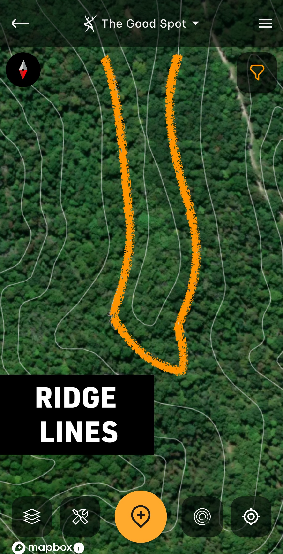
A ridge line displayed via the Contour layer.
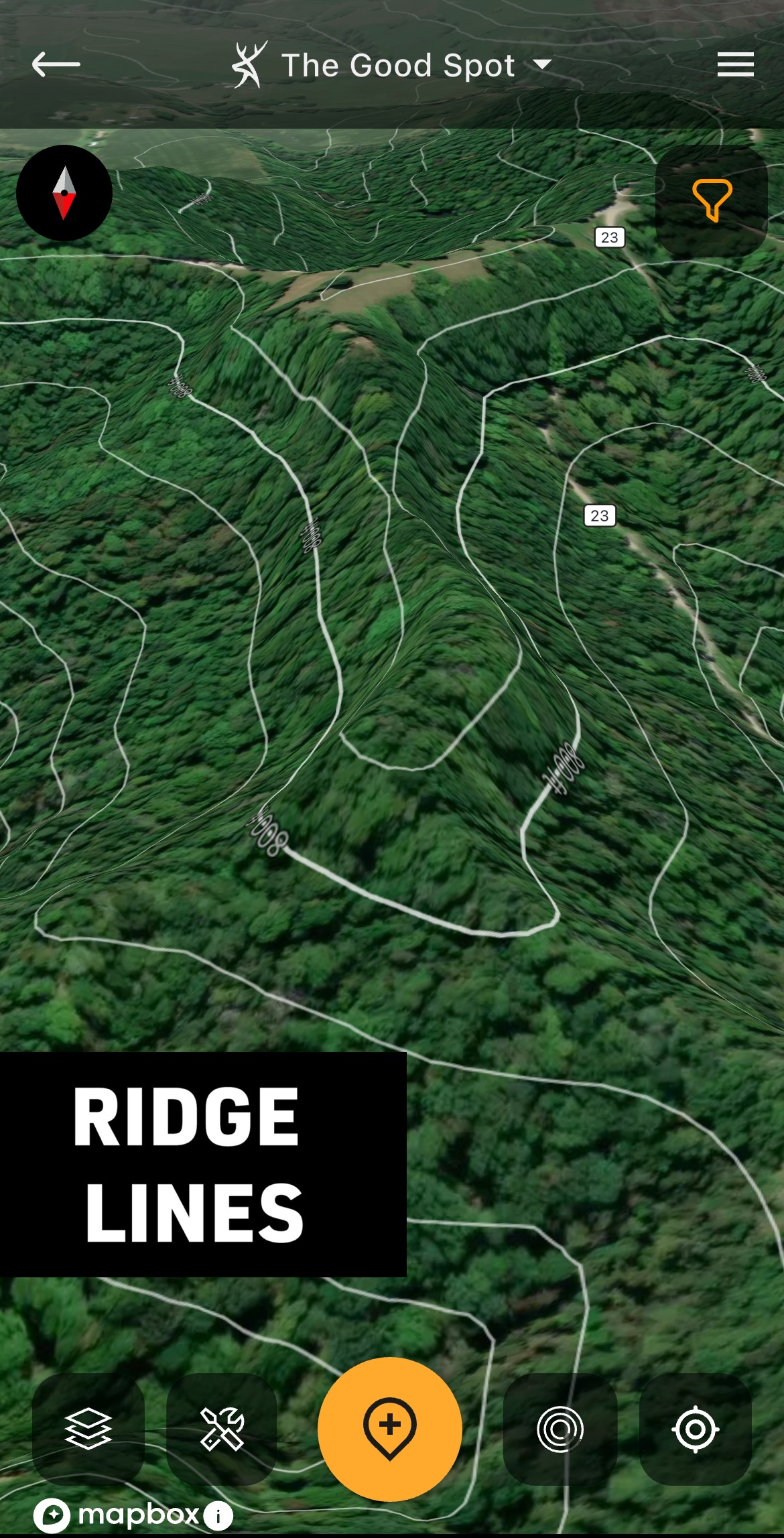
A ridge line shown in 3D.
Ridge Lines
Ridge lines are common in many parts of the country. These are best located by looking for the tightest and centermost lines in an area of the topo map.
Deer use ridge lines for travel, bedding, and feed. These can be premier bedding and food source locations. And if it’s a leeward ridge (the downwind side of it), mature bucks are quite likely to bed and travel along it.
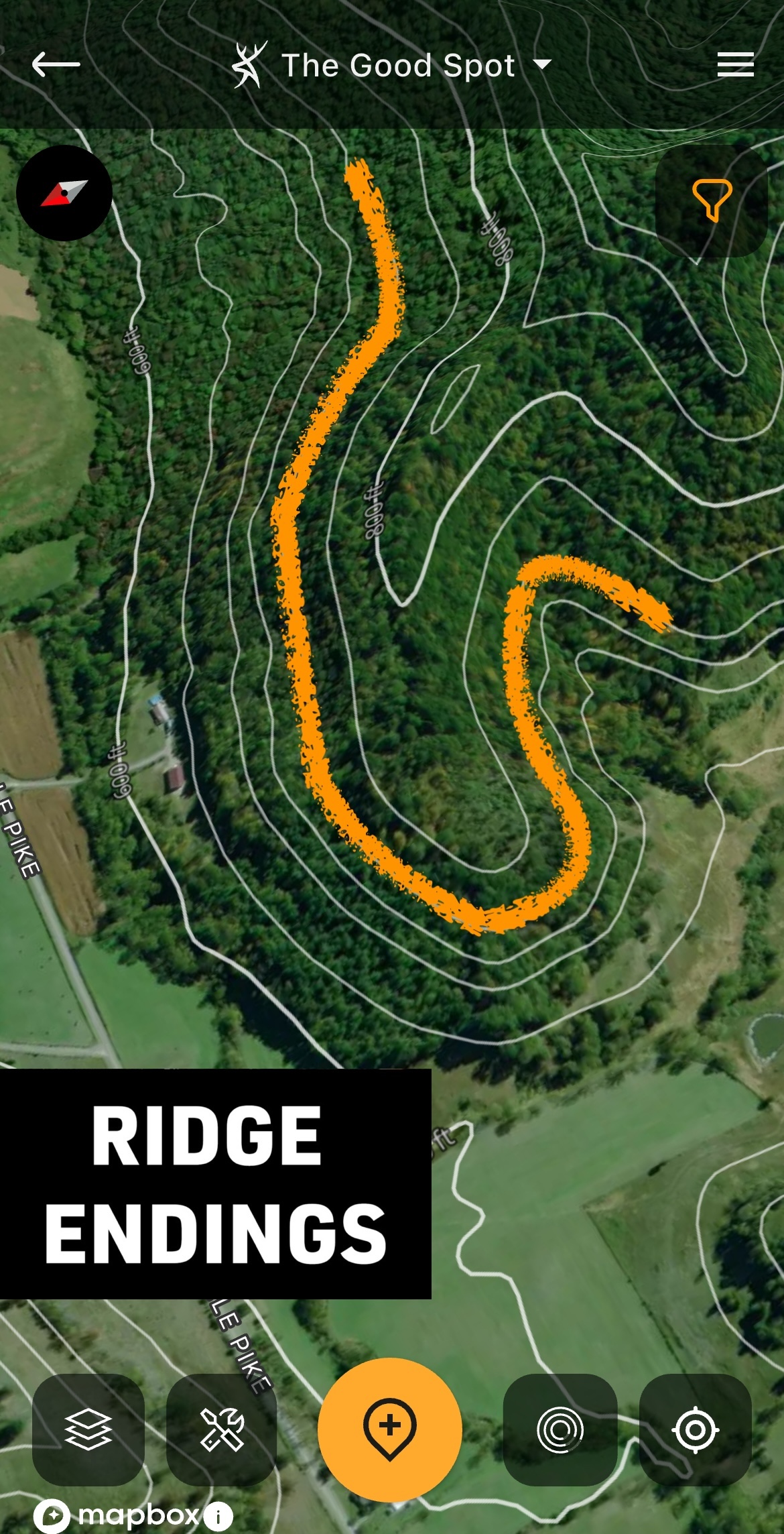
A ridge ending displayed via the Contour layer.
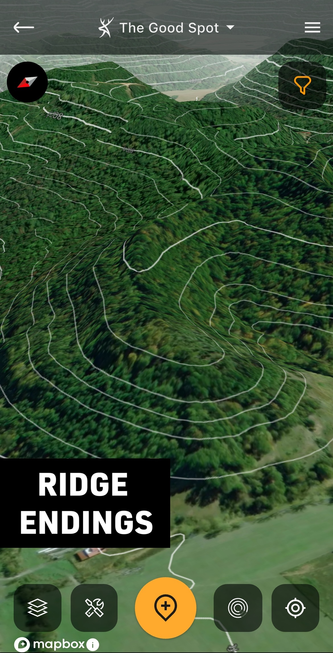
A ridge ending shown in 3D.
Ridge Endings
Commonly referred to as points, spurs, or ridge endings, the end of a ridge line is simple to identify. These are marked by tightly spaced contour lines that make sharp U turns or V shapes, indicating a downhill slope.
A ridge ending is commonly used as a bedding area, especially if it’s the leeward, downwind side of it.
HuntStand’s Whitetail Activity Forecast Tool
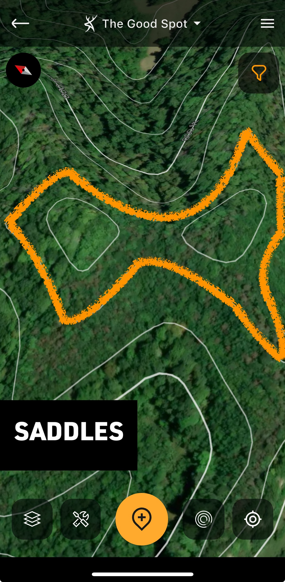
A saddle displayed via the Contour layer.
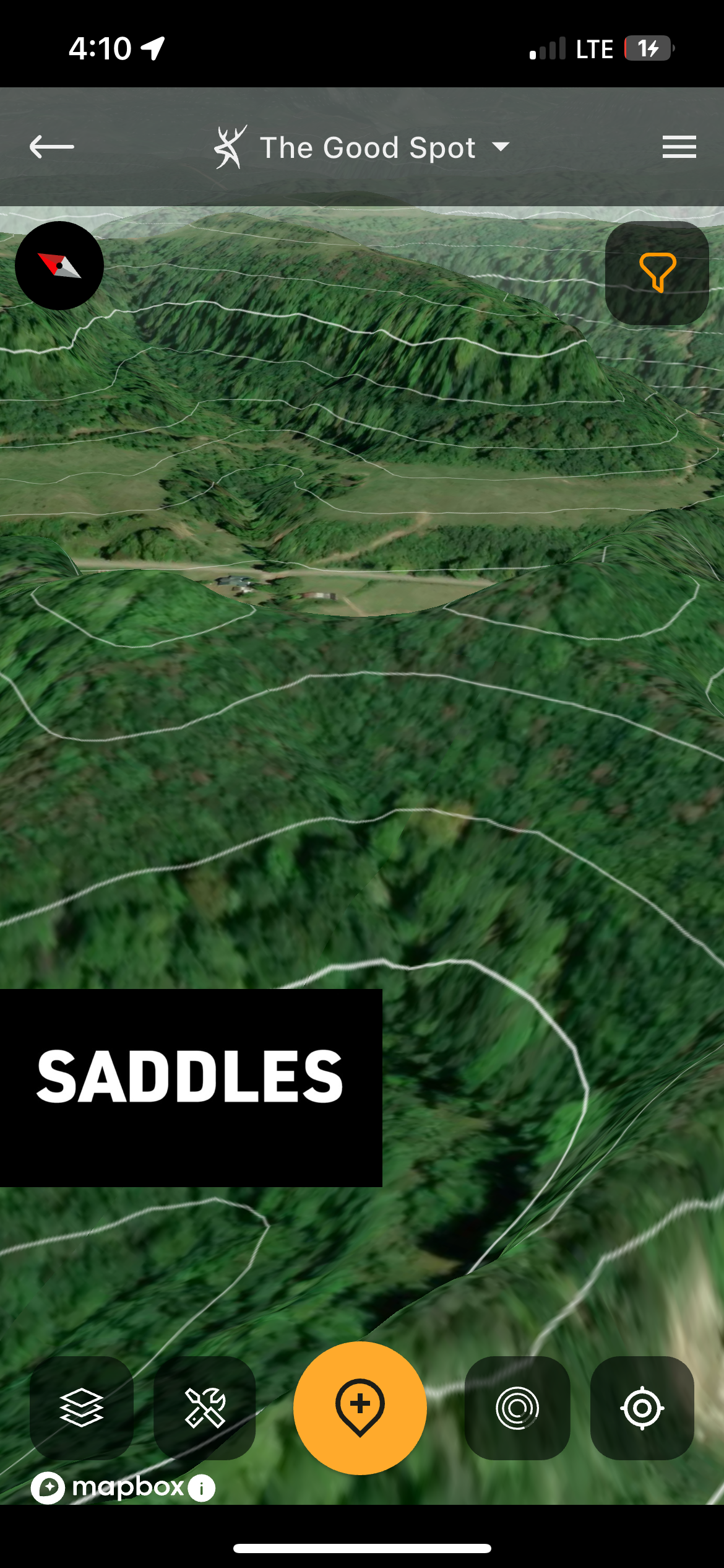
A saddle shown in 3D.
Saddles
A seam or cut that separates two ridges, saddles are quite simple to identify. These will appear as contour lines that look like two bullseyes separated by a figure-eight shape.
Whitetails frequently use the paths of least resistance. That’s especially true for bucks during the rut. Saddles allow them to cross over a ridge line without having to climb up and over difficult elevation changes.
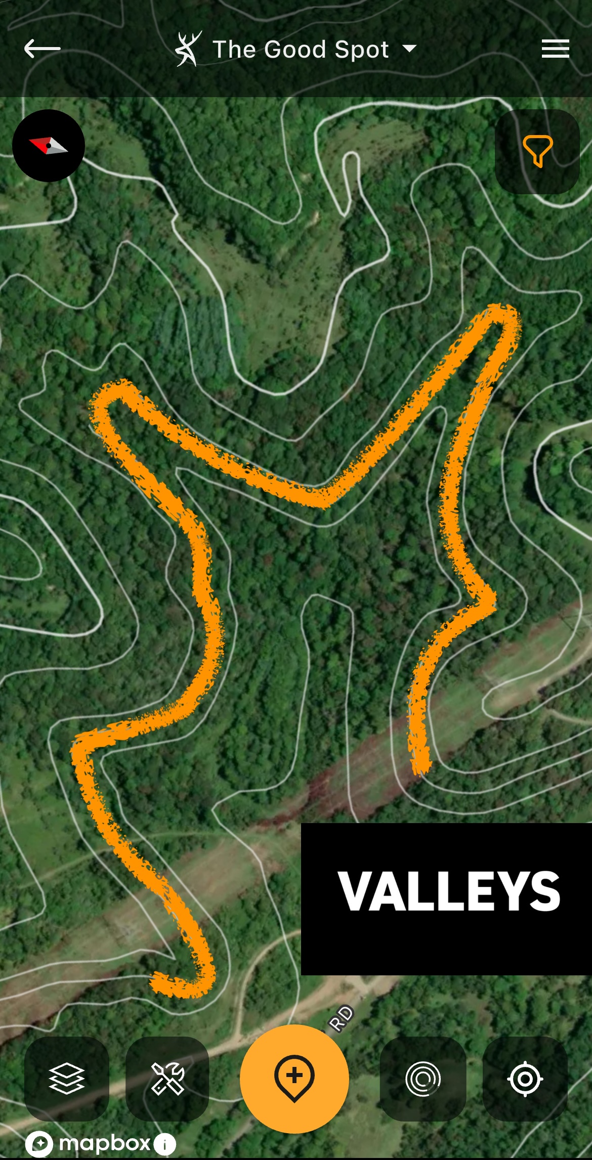
Valleys displayed via the Contour layer.
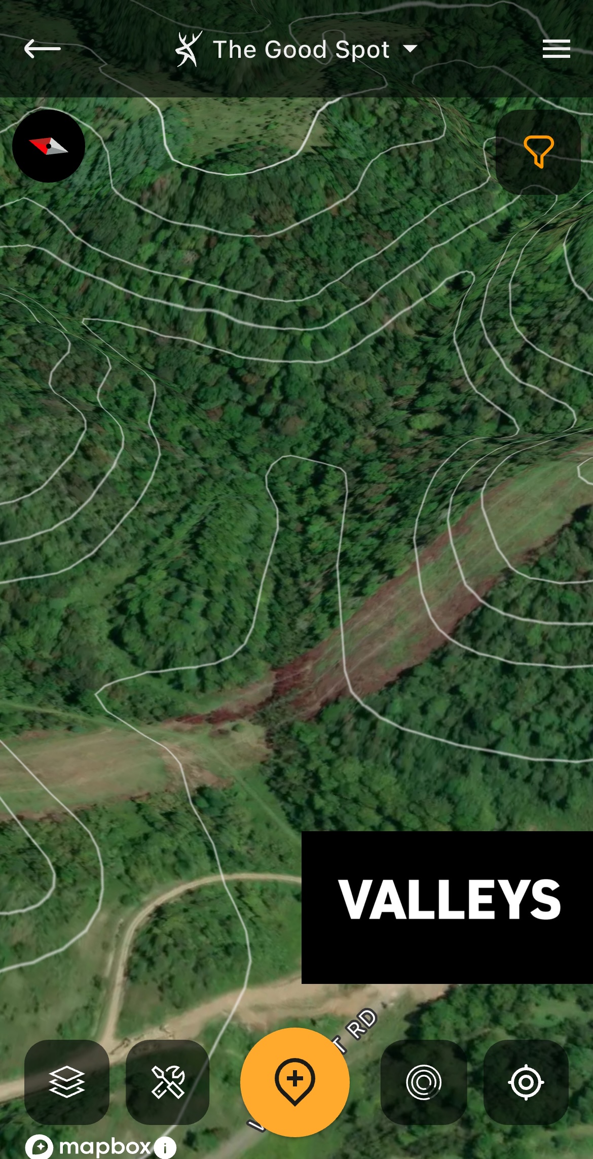
A valley shown in 3D.
Valleys
Sometimes noted as bottoms, gullies, or ravines, valleys are key terrain features. These are low-lying areas at lower elevations. Also, these are located below and/or between two or more ridge line systems.
Valleys tend to be difficult to hunt due to swirling winds. That said, when winds are somewhat predictable, and food sources are in these valleys, afternoon hunts can be productive.
These aren’t the only topographical land features of importance, but they are the most common. Look for these and others when studying maps for potential stand locations.
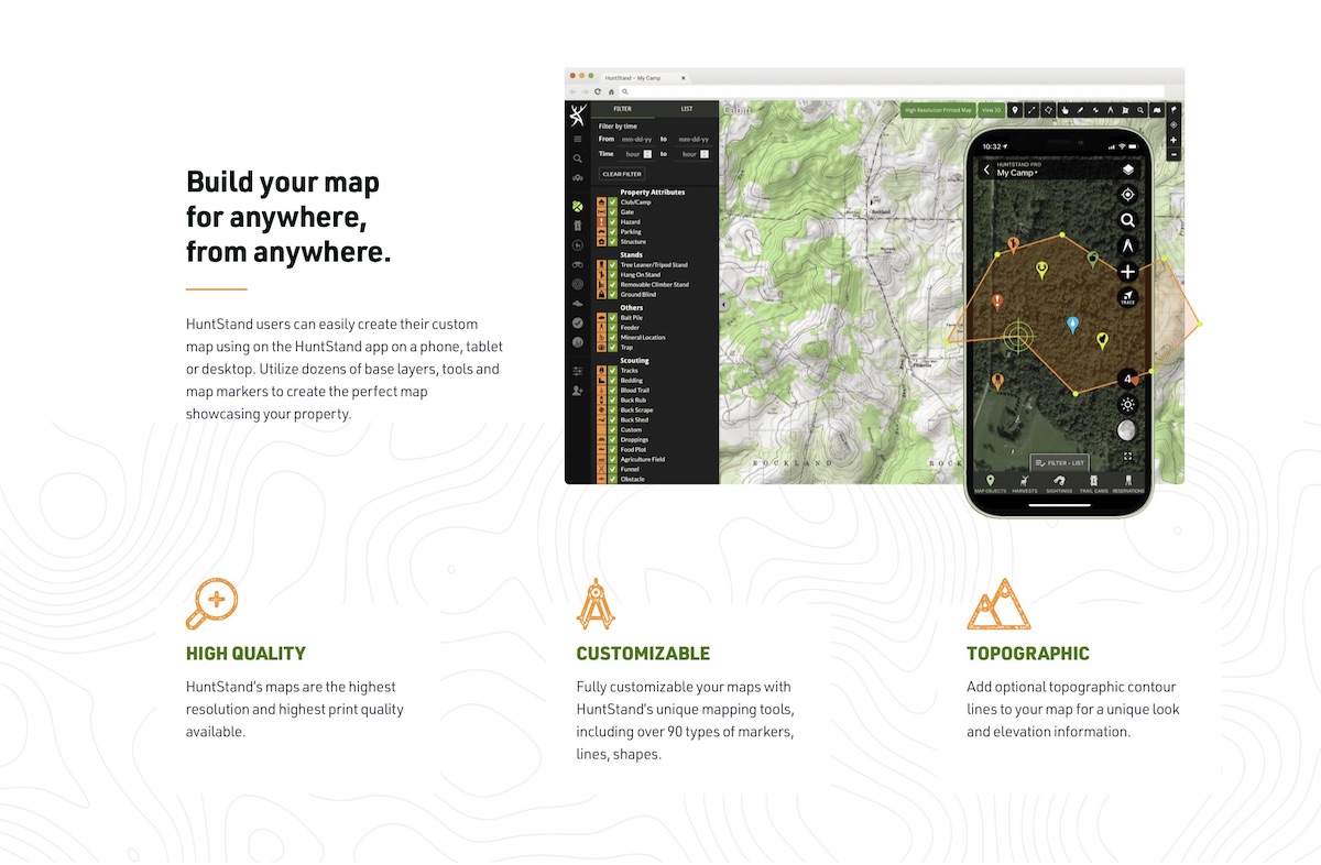
Printed maps can serve as an excellent supplement to your HuntStand app layers and tools.
HuntStand Printed Maps
High-quality maps are excellent tools for studying properties. Aerial views with overlayed topography lines show the important elements of a property. While an app version is more mobile and can do more, a larger view of a property via a printed map is ideal for studying macro and micro property details, marking treestands, trail cams, and other map objects.
HuntStand offers affordable, high-quality printed maps that serve numerous needs. These are ideal for finding deer with topo maps, explaining a hunting area to a guest, discussing stand locations, and much more. These come in various sizes and materials to fit different needs and requirements.
Find Public-Land Deer Hotspots on the Fly with HuntStand Pro
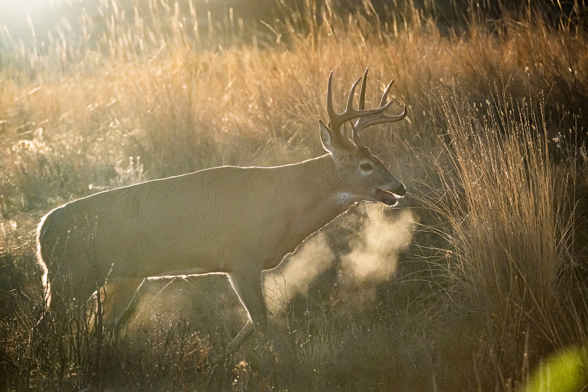
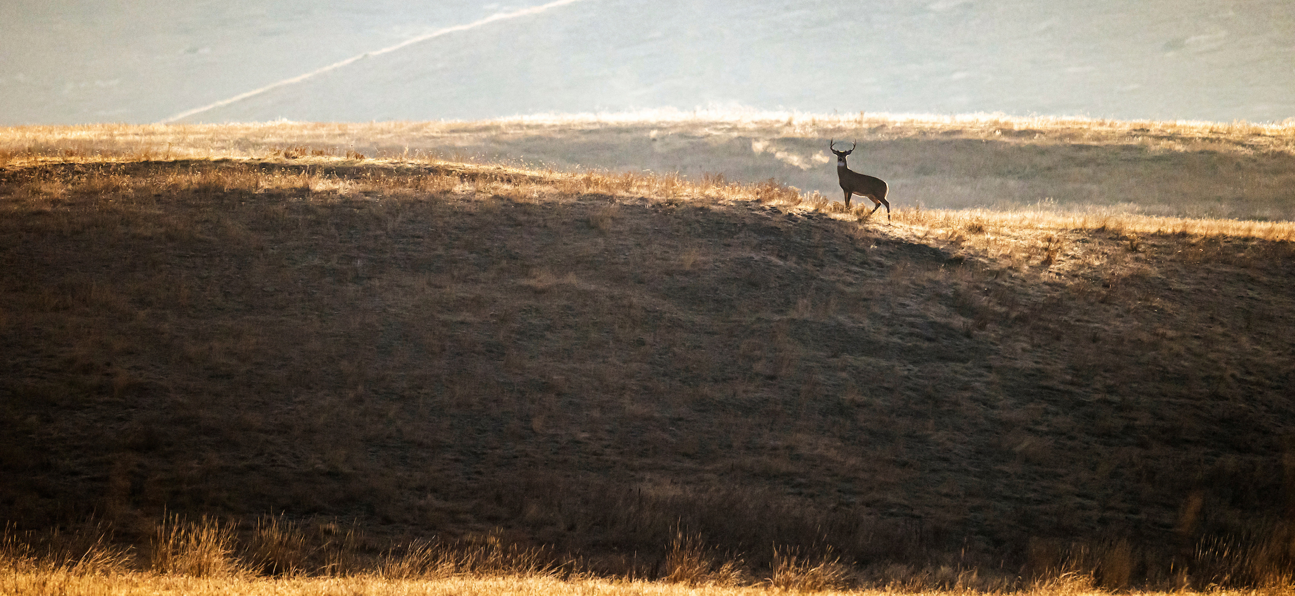
Rutting bucks routinely pass through saddles so they don't have to climb over ridges.
Method 1: Quad Topo
Quad Topo is a USGS topographic map feature that shows a vintage-style topography look. It showcases contour lines, elevation markers (in feet), waterways, forested areas, and more. If hunters enjoy an old-school look delivered in a new-school app, this is a phenomenal method for viewing topographic features.
Method 2: Contour Layer
Those who prefer an aerial view combined with easy-to-read contour lines should tap into the Contour layer. It offers Google Maps hybrid aerial imagery with overlaid topo lines.
Method 3: Terrain Layer
Laid on a gray background, the Terrain layer features effective use of shadowing to showcase the lay of the land. It uses Google Maps hybrid aerial imagery with shaded relief and landcover. For those wanting to visualize more than what topo lines alone offer, this is a great option.
Method 4: Outdoor Layer
The Outdoor layer is very similar to the Terrain layer. However, it uses a Mapbox outdoor layer with contour lines, trails, boundaries, and more. It even shows water sources, which are key elements of every hunting area.
Method 5: 3D Map Layer
The 3D Map layer is the most powerful hunting app layer available to consumers. This 3D view offers just that — a true three-dimensional look via your two-dimensional screen. It allows app users to “fly” through their hunt area and see exactly how the terrain rolls. It lets you see the topographic features just as they are in person.
Never has an app or map layer been able to give a hunter such an accurate depiction of the land. The 3D Map layer shows the habitat type as well as how the land rolls. In 3D, all of the above terrain features, and more, are highly identifiable and visible, even if you can’t read contour lines.
Whitetail Rut Map : A HuntStand Exclusive Feature

Try HuntStand Pro or Pro Whitetail to power your scouting efforts.
HuntStand Pro or HuntStand Ultimate
Deer hunters will be happy to know that HuntStand offers the above methods for identifying important topographic features. Those who choose HuntStand Pro will have access to powerful app tools and incredibly useful layers. Each of these will aid in the pursuit of your next whitetail. Unlike the free version of HuntStand, it’s an ad-free experience.
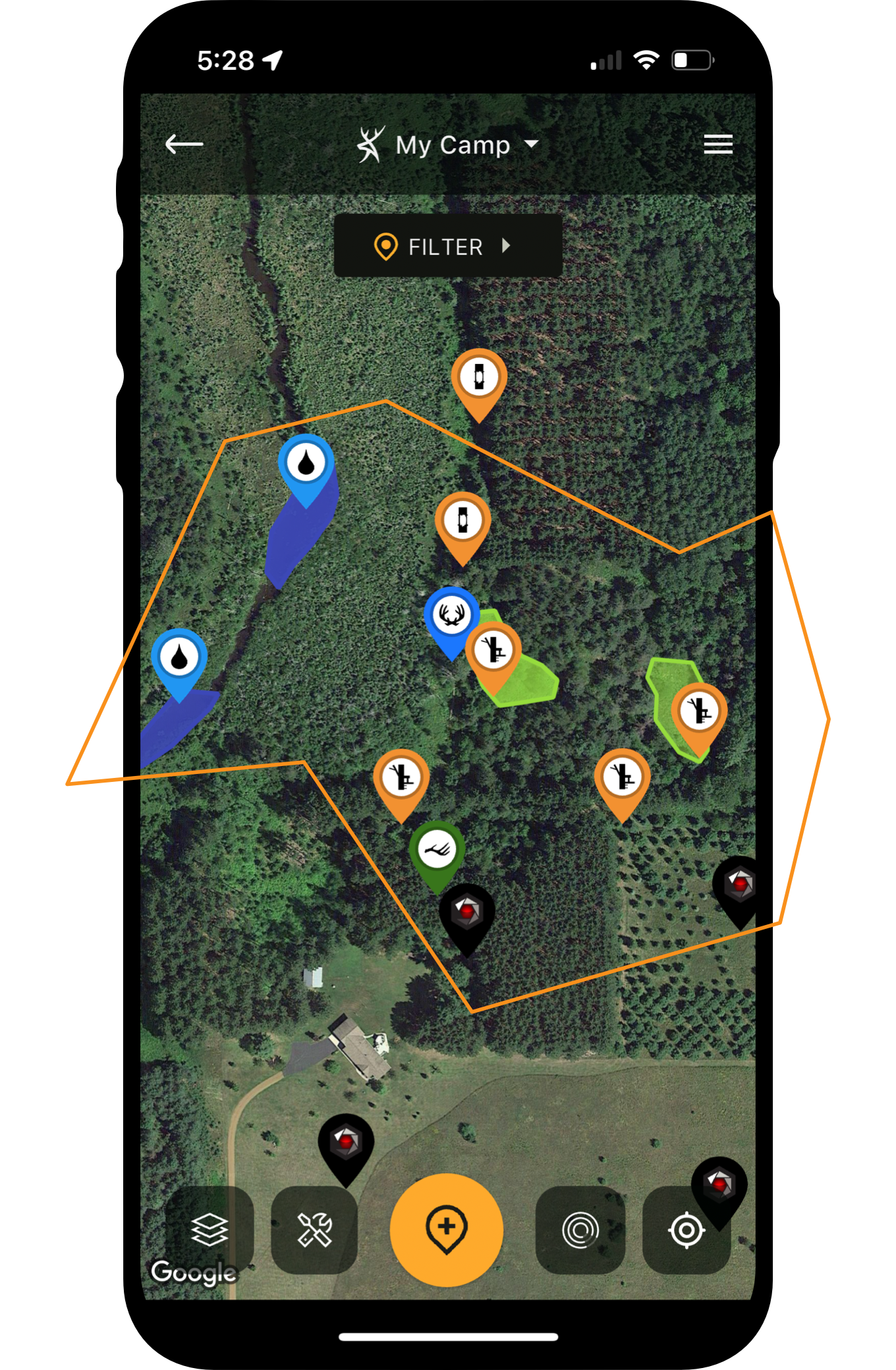
Includes: Advanced property search, monthly satellite imagery, offline mapping, premium map layers, property data, real 3D maps, stand reservations, trail camera management, treestand (and other gear) deployment management, weather overlays, and more.
Layers: 3D (true 3D viewing), Mapbox (Color-Corrected) Satellite, National Aerial Imagery, Natural Atlas, (General) Public Hunting Lands, (Detailed) Public Hunting Lands, TerraPulse Tree Cover, and more.
Price: $29.99 (per year)
While Pro is a very efficient subscription level, Ultimate is a must for serious deer hunters.
Includes: In addition to what’s include at the HuntStand Pro level, Ultimate also features Crop History, Whitetail Activity Forecast (detailing weather, wind and other conditions, plus daily hunt-quality scores), Nationwide Whitetail Rut Map (individualized data for each county), and much more.
Layers: HuntStand Pro layers plus additional layers: Nationwide Whitetail Rut Map, Whitetail Habitat Map, Crop History
Price: $69.99 (per year)