

Trail camera surveys can be taken before and after deer season.
Ever wonder how many deer you really have on your hunting grounds? Perhaps your state wildlife agency has given an estimate, but I’ll bet you know more than one guy who is skeptical of it. The Weekend Warriors think there are far fewer deer while the meticulous, serious guys might consider the estimate too low. This all provides plenty of fodder for debate in hunting camp or at the local coffee shop. The truth often lies somewhere in between, and thanks to an infrared-triggered camera survey technique developed by a team of researchers from Mississippi State University, you can actually come up with a fairly accurate estimate all on your own.
Run deer population surveys before deer season for the most accurate pre-harvest ratio.
Conducting a Deer Population Survey
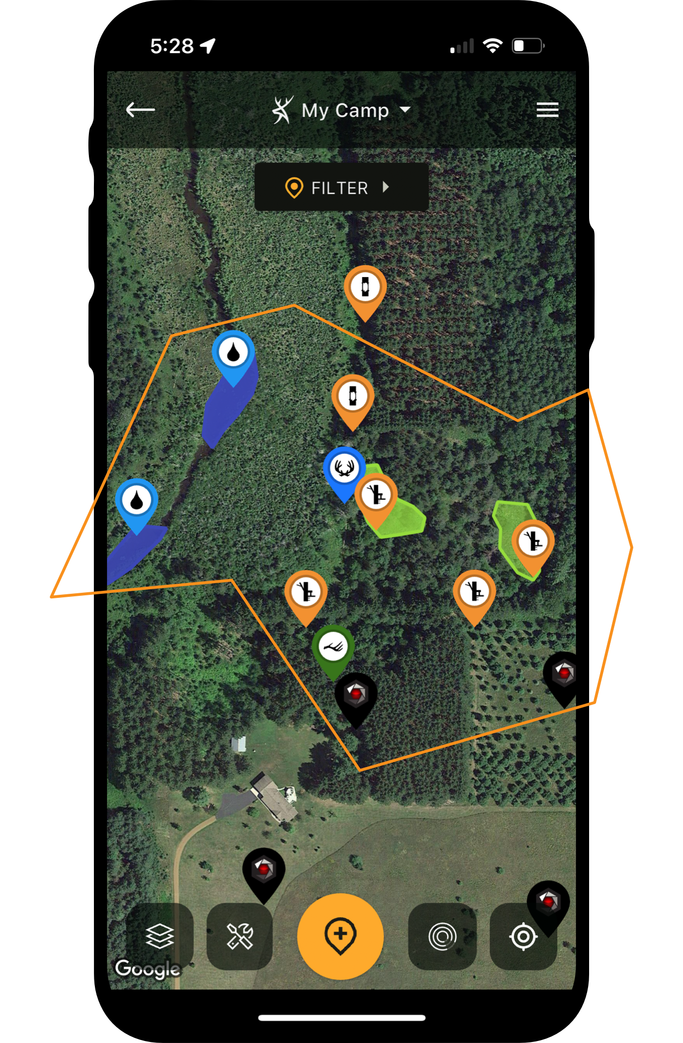
According to MSU researchers Dr. Stephen Demarais, William McKinley and Dr. Harry Jacobson, who developed the technique, one camera per 100 acres is sufficient. I’m guessing you already have a few cameras out, and if you’re using HuntStand to its maximum potential, you have their positions saved. So, open up your map and see if you meet the desired ratio. Add or subtract as needed but don’t worry about being too precise, or having too many cameras.
Cameras need not be evenly spaced. It’s okay to bias your results by placing cameras in areas heavily utilized by deer, and it’s helpful if you can access them easily. Two-tracks, skid roads, and the edges of food plots or agricultural fields or heavily traveled deer trails, are all ideal.
You also need to pair a feeding station (check local regs) with each of your survey cameras. If you’re already feeding, you’re ahead of the game. Existing supplemental feed stations are probably close to the desired 1:100 ratio. You likely have a camera on them already, and have them plotted in HuntStand. Also, deer are conditioned to visiting them. You’ll have to pre-bait new sites for at least five days before running your surveys.
How to Chart a Buck’s Home Range and Core Area with HuntStand Markers
For optimum results, conduct two surveys, one before hunting season and the other after. Again, be sure to check the baiting laws in your state. If baiting is not legal where you hunt, conduct the first survey far enough in advance of hunting season to meet legal requirements. You can begin as early as late August, and end as late as early February. In any case, provide enough feed so there is some present at each station throughout the survey period.
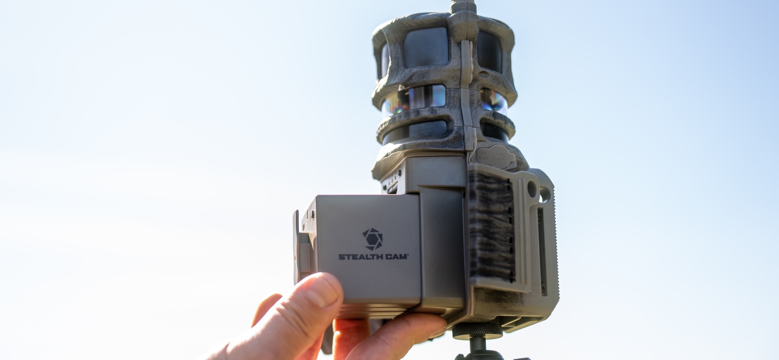
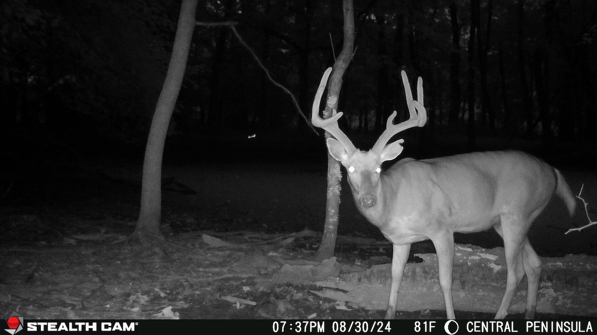
To begin, make sure cameras are working properly and loaded with fully charged batteries. Set the stamp to record date and time on each photo and set cameras on a 10-minute delay to avoid a glut of unnecessary images. You’ll also find it helpful to clear all vegetation from the detection zone and face cameras north or south to avoid backlighting and prevent false events.
Short survey periods of 5 to 10 days are adequate, but you’ll achieve greater accuracy with a longer 10- to 14-day survey. This should ensure you are photographing close to 90% of bucks and does in your area.
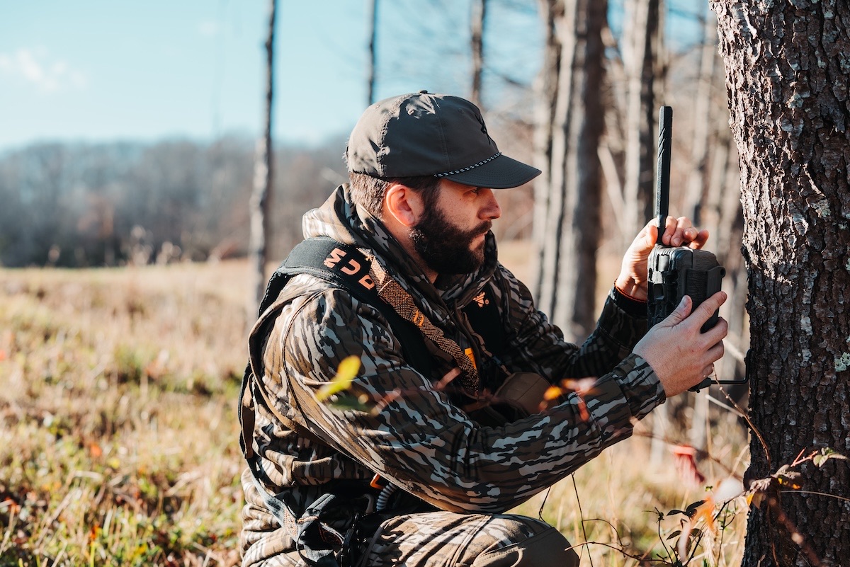
Use a reliable camera, such as Stealth Cam models.
Analyzing Your Trail Camera Images
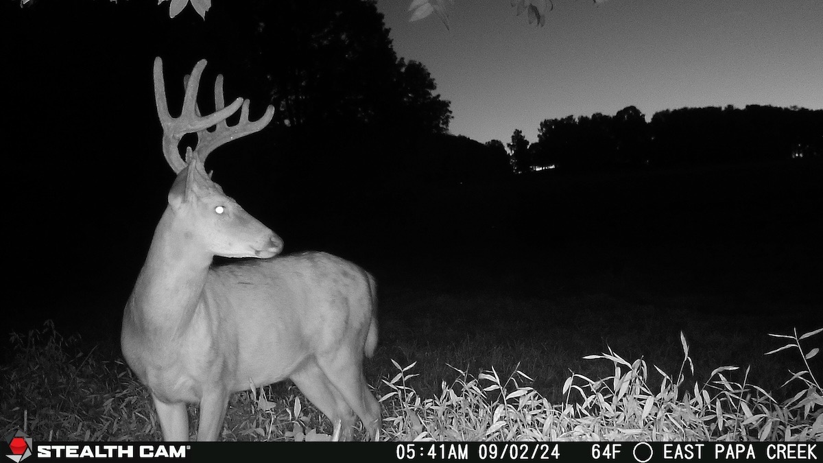
After the surveys are complete, compile all of your photographs and carefully count the number of bucks, does, and fawns. For bucks, count: 1) total number of bucks in the photos, including repeats; 2) actual of number of individual (unique) bucks. This is most easily done using antler characteristics such as number of points, abnormal points, tine length, spread or other distinguishable antler or body characteristics. Exclude any deer that are unidentifiable from the survey (there will usually be a few). The result will be your buck population.
For does and fawns, count the total number of does and fawns in the photos, including known repeats. Estimating (and yes, this is an estimate) the number of does and fawns takes a few simple calculations. Take the number of unique bucks (#2 above) and divide this by the total number of bucks photographed (#1 above). Then multiply the resulting population factor (#2 divided by #1) by the number of does and fawns counted in the photos. That’s it.
The 5-Step Scouting Plan to Pattern Mature Bucks
From this information, you can also calculate a buck:doe ratio and a fawn:doe ratio. If you’re skilled enough, you can even take a stab at aging the bucks, then sort them by age class to determine age structure. Repeating the survey over multiple seasons allows you to observe trends, which can be more valuable than an actual population estimate for any given year.
By the end of each survey, you’ve also collected a wealth of information that can have direct hunting applications. For example, by integrating the Command Pro app (for Stealth Cam and Muddy cameras) all photos will import and save in HuntStand by location. By studying the time and date of each photo and then comparing them to locations on your HuntStand map, you might be able to detect patterns — such as where a particular buck is likely to be at a certain time, or how he moves through the property. Post-hunt photos can tell you which bucks made it through the season and where to start your search next year.
Conduct surveys to determine herd health.
Digging Deeper to Learn More
And that’s just scratching the surface. There’s plenty more you can garner from combining your survey results with the many HuntStand features, and we’ll tell you about them in the weeks and months ahead.