



Use HuntStand to map out the next move on a hunt
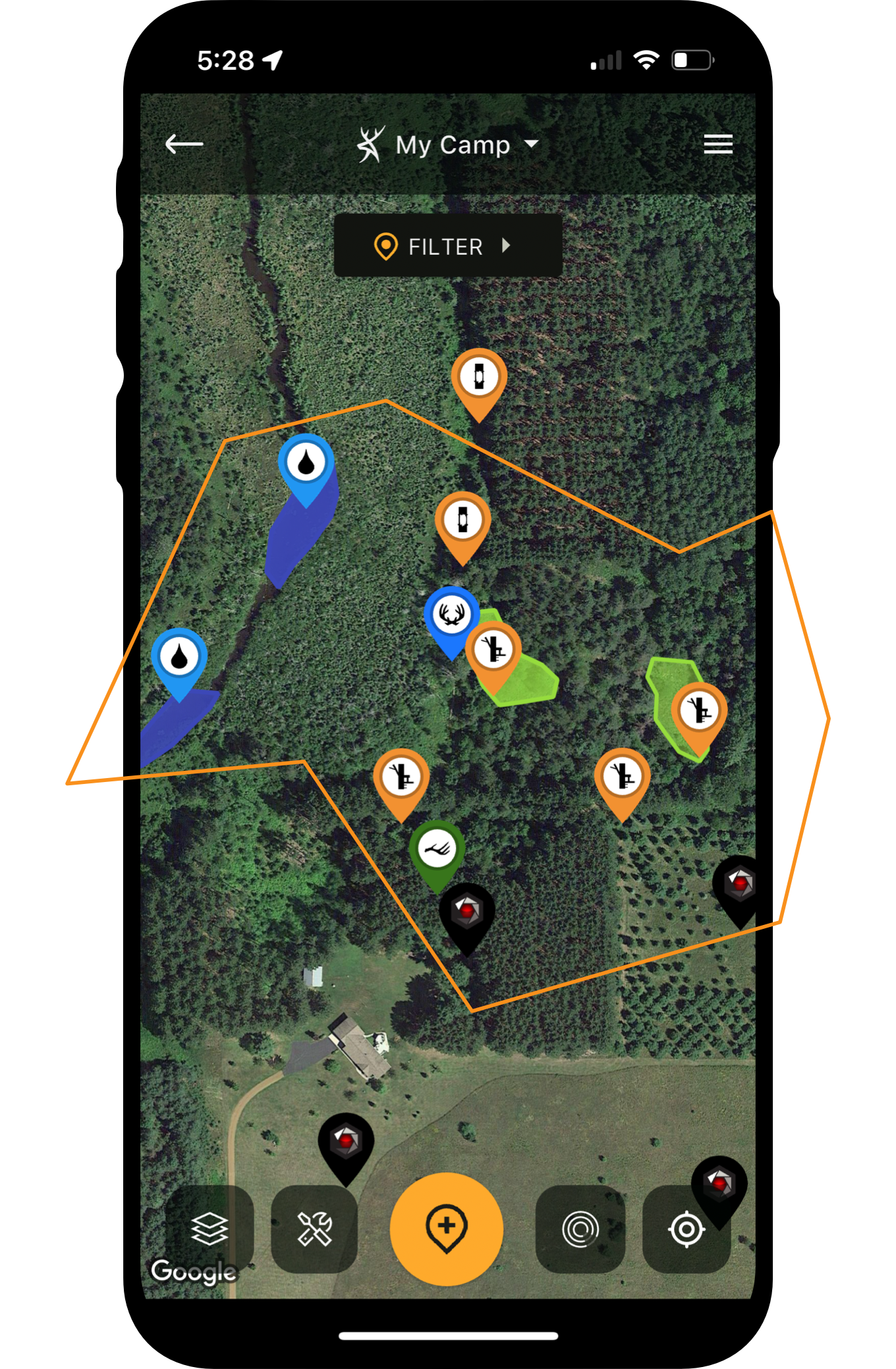
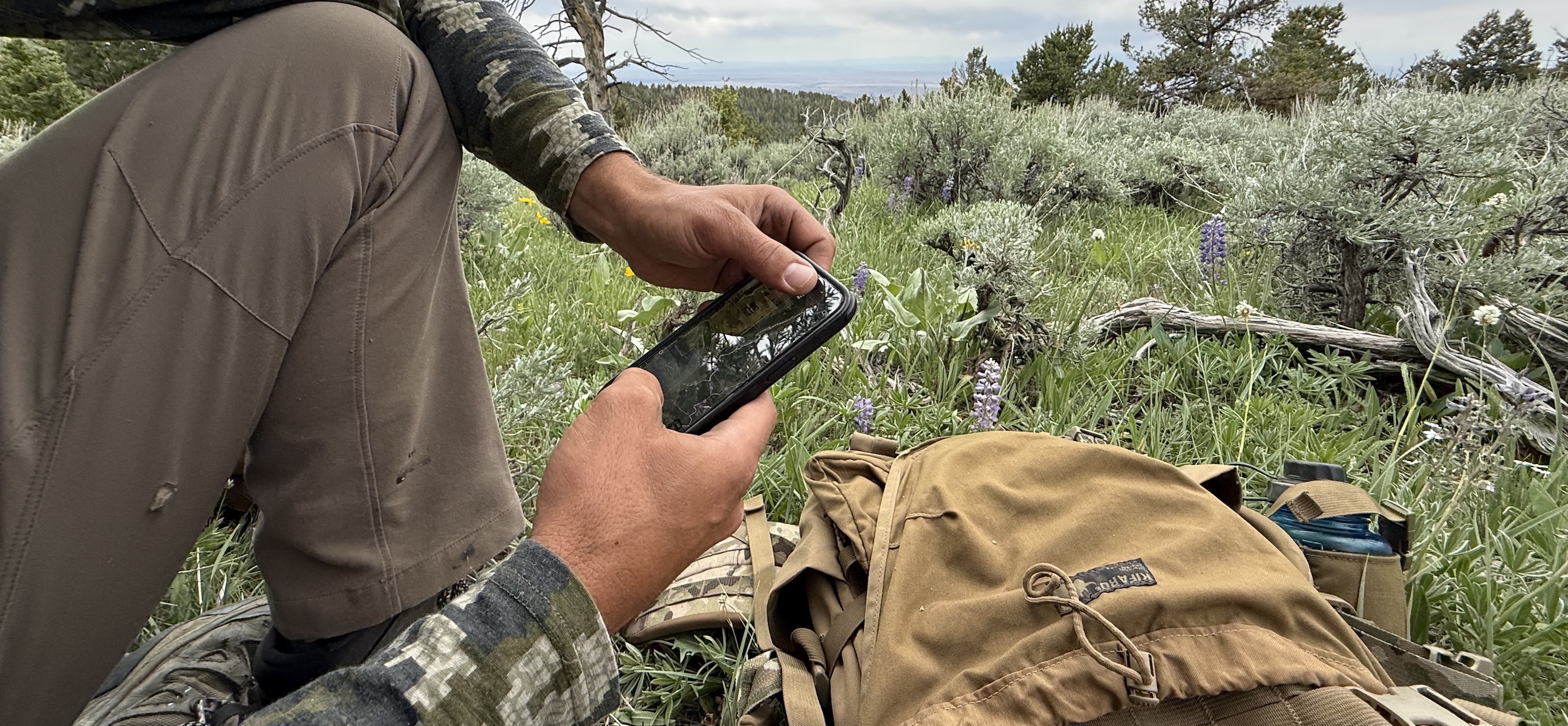
You might still be able to hunt your uncle’s small Midwestern farm without the use of a hunting app. However, hunters who regularly travel to hunt other regions of a state or to other states and beyond, would benefit greatly from a hunting app. As a traveling hunter, I understand the importance of a quality hunting app like HuntStand, especially the HuntStand Ultimate edition. Apps such as this give you freedom to plan hunts from the comfort of your home. You can locate hunting land opportunities without spending money on fuel for multiple scouting missions or missing hunting days while scouting after arriving. Also, you can zero in on locations based on detailed use of a variety of map features. You can even use special features, such as HuntStand’s rut maps to plan prime hunting dates.
So, what are the best features of a hunting app? The following are several handpicked features that I appreciate as I develop strategies for future hunts and utilize while in the field. Honestly, there are too many features on any good app to outline in one article but directing your attention to these starting points puts you on the path to a successful hunt.
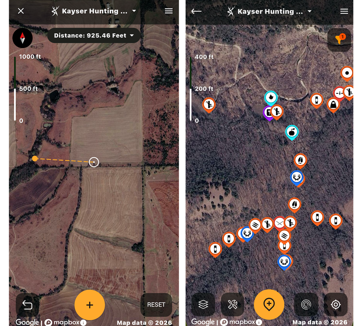
Deploy the HuntStand Hybrid map in a good overall view. This is the HuntStand Hybrid map with the Distance tool in use.
Using Aerial Maps in Hunting Apps
Nothing helps you more in understanding a hunting area, especially those you have not visited, than an aerial overview. Looking down at a hunting area from above provides immediate information if an area offers what you are looking for in habitat. Tree canopy cover, pastures, agricultural land, large water sources and established roads are evident. HuntStand’s Hybrid and Satellite base layers are great starting points to boost or lower your confidence.
When detailed analysis is required, other HuntStand overlays bolster your scouting. These overlays include Water Features, Tree Cover, Crop History and even comprehensive Soil Classification to give you insight on whether ground offers worthwhile elements for food plots or even productivity on surrounding farms.
And remember, satellite images are stored. Some images might be more than a year old with drastic changes possibly occurring on the land. For instance, some cropland might be transitioned into grasslands, woodlots might be cleared for agricultural purposes and wildland fires might have decimated a mountainside. HuntStand’s Monthly Satellite base layer provides newer images at a lower resolution, yet sharp enough to see any major land transformations that occurred in the previous month.
Every hunt needs to kick off with an overview of the property to put you in the driver’s seat of any upcoming hunt.
A Detailed Guide to HuntStand App Tools for Deer Hunters
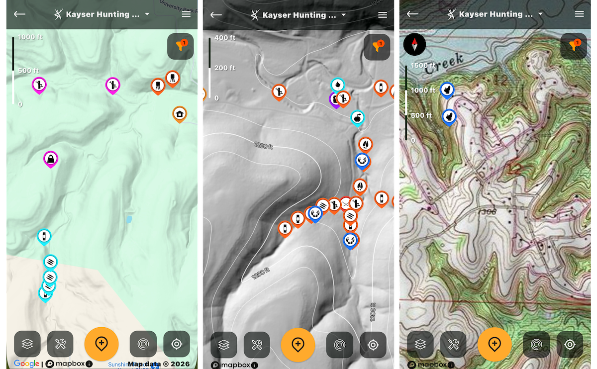
HuntStand Lidar layers can be implemented for terrain overview.
Scouting Terrain Details and Topo Maps in Hunting Apps
Once you know you are on the right property, hunting apps decipher the terrain that is in plain view or that it’s veiled under a dense canopy of timber. That’s important not only for you to avoid terrain obstacles that could impede your hunt or even prove to be dangerous, but most game species instinctively use terrain to their advantage.
HuntStand offers multiple base layers and overlays to keep you informed of all geographic features in an area. On the base layer side you can choose from Quad Topo, Outdoor, Terrain and even take a trip over an area with detailed visuals via the use of Lidar. The Contour overlay adds more information for you to seek out important land aspects such as ridge-tops, saddles, steep river breaks and vast flatlands.
Why is terrain important? Turkeys sometimes balk at climbing sheer hillsides. Elk often use saddles to traverse from mountain to mountain and whitetails love a good edge, hidden or in the open. Study up on game behavior and merge it with HuntStand terrain features for a guaranteed hunt meet-and-greet. When you find that X-marks-the-spot location, visit HuntStand’s Gear Store for deals on treestands and more.
How to Chart a Buck’s Home Range and Core Area with HuntStand Markers
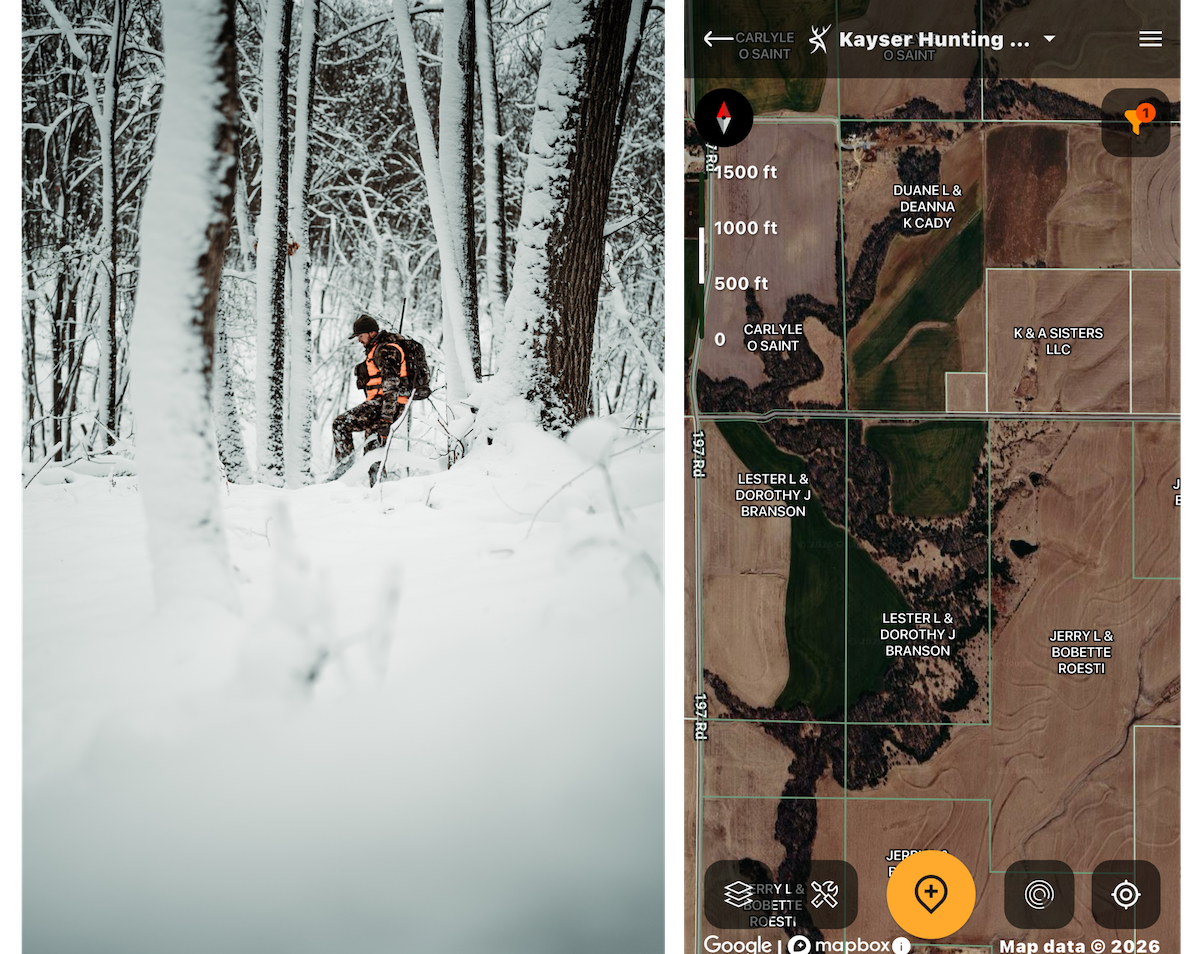
The Hybrid map with Property Info overlay in use.
Searching Property and Landowner Information in HuntStand
No scouting mission or hunt would be complete without understanding who owns a property, the extensiveness of public lands, surrounding landowners and even detailed information to reach out and possibly acquire additional access to hunt an adjacent property. Deer, elk, turkeys, predators and the likes roam large territories that might cross several property borders. Having access to property details is a hunting app necessity and HuntStand shines with a variety of platforms to provide property particulars.
First, pull up an overview base layer, like the Hybrid feature. Then, slide over to the overlays and click on Property Info. Immediately your screen adds who owns a specific piece of land and with a tap of the screen, additional information pops up for possible contact. This feature is invaluable in areas with limited public lands when trying to secure added hunting property.
Say you fail in this outreach attempt or are blessed to hunt a public-land rich area. HuntStand provides not one, but two features to locate these public lands you own or have access to. Again, start with a Hybrid or Satellite baser layer and then move to overlays for use of the Public Lands or Hunting Lands information superimposed on the satellite image. State, federal and unique public land ownership information guides you to possible properties that allow hunting. You will be amazed at some of the most overlooked hunting opportunities scattered across the country.
Use HuntStand’s Property Lines Feature for Deer Hunting
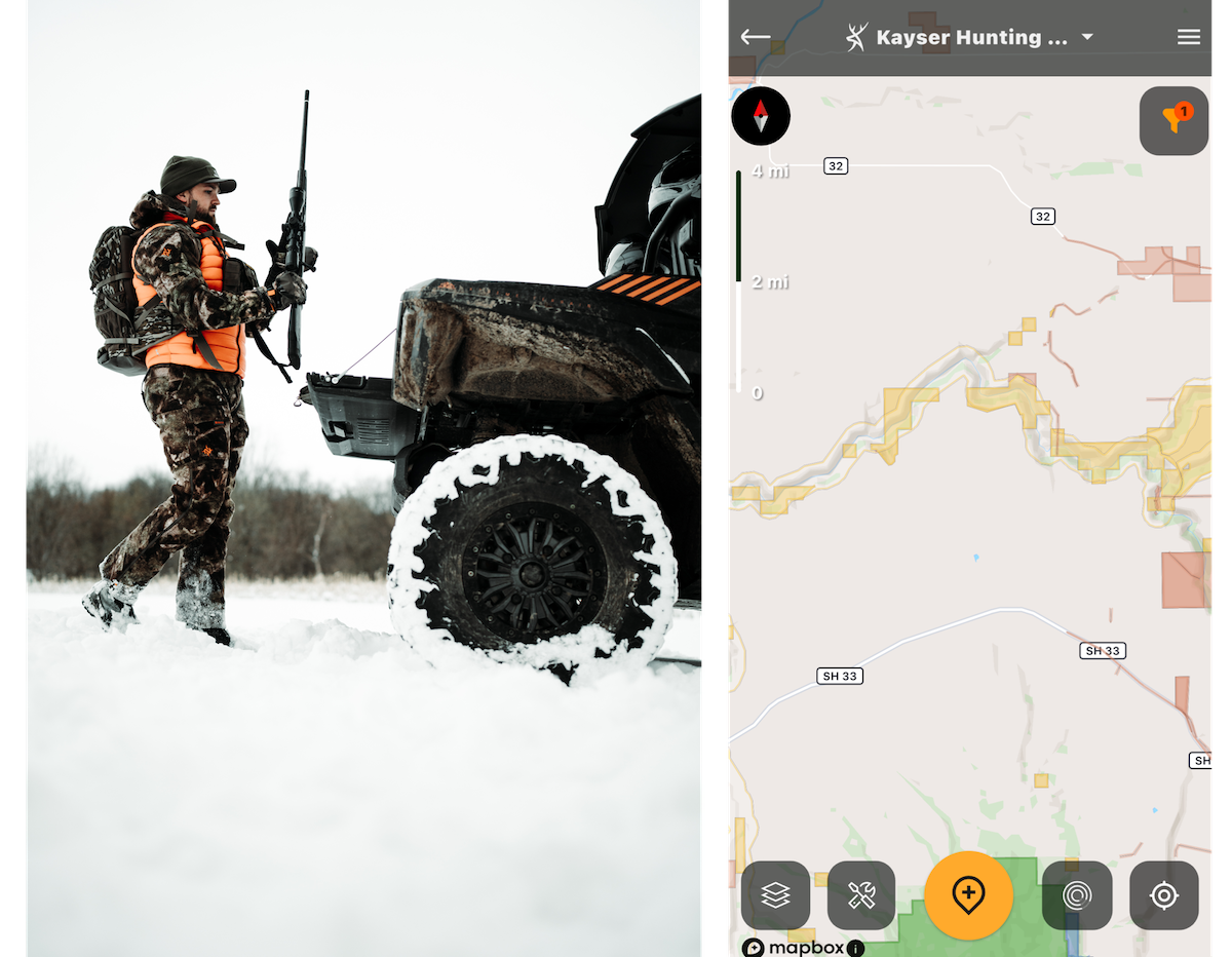
Use layers showing streets and roads to navigate larger hunting properties.
Using Street and Road Maps in Hunting Apps
You do not have time to waste on a hunt, especially on one using vacation days. Time is of the essence, and your hunting app needs to reflect urgency in travel efficiency. HuntStand provides multiple features to show you where on earth you are at with routes to get you in and out. Start off with the use of the Hybrid base layer that integrates roads along with major road and trail designations on vivid satellite images. For a more old-school map-feel turn to the Natural Atlas or Outdoor base layers depicting roadways, plus other major features in easy-to-use platforms.
Of course, you cannot go wrong with the basic Street base layer that is so easy to read you will not need Siri urging you to “reroute, reroute.” And the HuntStand 3D Mapbox Street base layer blends detailed travel routes with a visually enhanced map of any hunting area. Tools, like the Track and Distance measuring instruments also aid in any travel decisions, especially those that might represent backcountry treks.
How to Plan for Public-Land Elk Hunting
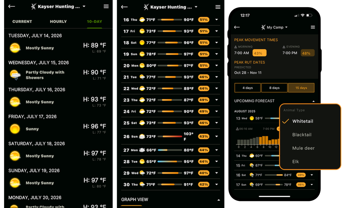
HuntStand offers a 10-day weather forecast.
Weather Maps, Layers, Toggles, and other Tools in HuntStand
Just taking a gander at a hunt area using the Hybrid base layer ranks at the top of my HuntStand uses but it is closely followed by digging deep into the weather aspects of the app. Regardless of the species you hunt, turkeys to whitetails, predators to elk, your actions and their behaviors are dictated by weather. Fortunately, HuntStand supplies you with thorough weather data to plan a hunt in minutes, days or more than a week out.
Weather data jumps out at you when opening the feature with current details such as temperature and cloud cover but also barometric pressure, visibility, humidity, recent precipitation, wind variables and even a UV index that might come in handy sitting in a September sunflower field waiting for doves to arrive.
Add an hourly and 10-day forecast to make sure you are prepared for weather changes now or later during a hunt. And valuable on any hunt where olfactory senses of your quarry trump your own, the HuntZone wind analysis gives you an all-inclusive graphic of the wind direction, your scent dispersion plus hourly and daily forecasts to be able to move or change ambush sites in preparation for wind events to come.
In closing, if you love The Weather Channel forecasts you will jump at the chance to use HuntStand’s Whitetail Rut, Mule Deer Rut, Blacktail Rut and Elk Rut maps all based on meticulous rut data of each individual species. You will soon forget about streaming weather forecasts and study HuntStand’s rut maps for unequaled activity forecasts.
What Do You Get with a HuntStand Ultimate Subscription?
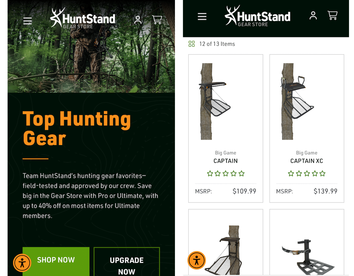
The HuntStand Gear Store is great for deals on treestands and up to 50% off.
These are some of my go-to features on a hunting app and to unleash them all I utilize HuntStand’s Ultimate version of the app. A multitude of integrated extras augment these and every feature on the app and I didn’t even touch on trail camera integration aspects along with the great deals in the HuntStand Gear Store. That’s a highlight for another article or you’ll have to dive in and discover the proficiency yourself.